Size of this PNG preview of this SVG file: 330 × 599 pixels. Other resolutions: 132 × 240 pixels | 264 × 480 pixels | 423 × 768 pixels | 564 × 1,024 pixels | 1,128 × 2,048 pixels | 803 × 1,458 pixels.
Original file (SVG file, nominally 803 × 1,458 pixels, file size: 434 KB)
File history
Click on a date/time to view the file as it appeared at that time.
| Date/Time | Thumbnail | Dimensions | User | Comment | |
|---|---|---|---|---|---|
| current | 15:51, 23 September 2009 |  | 803 × 1,458 (434 KB) | NordNordWest | |
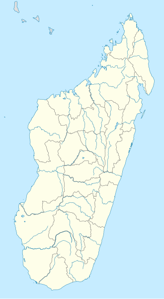
| 19:26, 14 October 2008 |  | 803 × 1,458 (368 KB) | NordNordWest | {{Information |Description= {{de|Positionskarte von Madagaskar}} Quadratische Plattkarte, N-S-Streckung 105 %. Geographische Begrenzung der Karte: * N: 11.3° S * S: 26.0° S * W: 42.5° O * O: 51.0° O {{en|Location map of [[:en:Madaga |
File usage
There are no pages that use this file.
Global file usage
The following other wikis use this file:
- Usage on ba.wikipedia.org
- Usage on bn.wikipedia.org
- Usage on ceb.wikipedia.org
- Usage on ckb.wikipedia.org
- Usage on de.wikipedia.org
- Usage on en.wikipedia.org
- Antsiranana
- Mahajanga
- Andoany
- Vatolaivy
- Toamasina
- Battle of Madagascar
- Mahalevona
- Fort-Dauphin (Madagascar)
- Toliara
- Nosy Be
- Fianarantsoa
- Antsohimbondrona
- Amparafaravola
- Antsirabe
- Antanifotsy
- Manakara
- Morondava
- Nosy Boraha
- Île aux Nattes
- Vatomandry
- Brickaville
- Vohemar
- Morombe
- Maroantsetra
- Banc du Geyser
- Anjozorobe
- Vangaindrano
- Marosakoa
- Ambenja
- Analalava
- Ambanja
- Anorotsangana
- Tsivory
- Betroka
- Ranotsara
- Ikalamavony
- Ambatofinandrahana
- Ihosy
- Bekisopa
- Soavina
- Solila
- Befotaka
- Iakora
- Zazafotsy
View more global usage of this file.


 Français
 Italiano


