
 Français
 Italiano
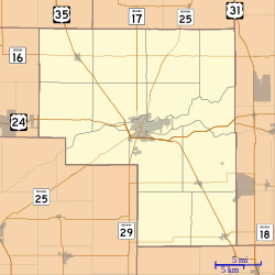
Size of this PNG preview of this SVG file: 600 × 600 pixels. Other resolutions: 240 × 240 pixels | 480 × 480 pixels | 768 × 768 pixels | 1,024 × 1,024 pixels | 2,048 × 2,048 pixels.
Original file (SVG file, nominally 768 × 768 pixels, file size: 221 KB)
This is a file from the Wikimedia Commons and may be used by other projects. Information from its description page there is shown below. Commons is a freely licensed media file repository. |
Summary
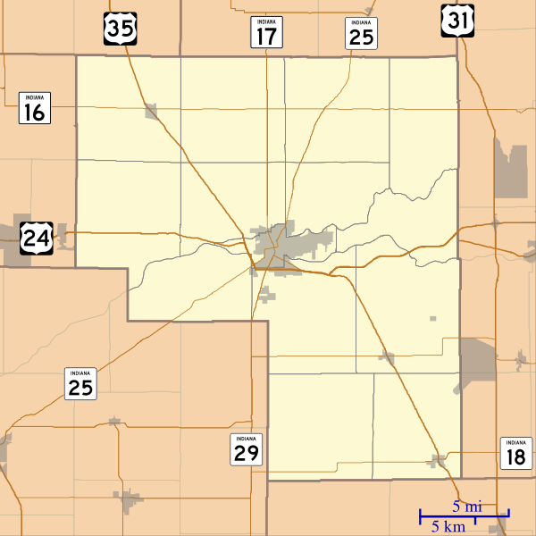
| Description | English: This is a map of Cass County, Indiana, USA which includes incorporated settlements, township borders, and major highways. |
| Date | |
| Source | My own work, using custom-written MapScript applications with United States Census Bureau data |
| Author | Omnedon |
Licensing
| I, the copyright holder of this work, release this work into the public domain. This applies worldwide. In some countries this may not be legally possible; if so: I grant anyone the right to use this work for any purpose, without any conditions, unless such conditions are required by law. |
File history
Click on a date/time to view the file as it appeared at that time.
| Date/Time | Thumbnail | Dimensions | User | Comment | |
|---|---|---|---|---|---|
| current | 03:12, 18 September 2012 | | 768 × 768 (221 KB) | Omnedon | == {{int:filedesc}} == {{Information |Description={{en|This is a map of Cass County, Indiana, USA which includes incorporated settlements, township borders, and major highways.}} |Source=My own work, using custom-written [ht... |
File usage
There are no pages that use this file.
Global file usage
The following other wikis use this file:
- Usage on ar.wikipedia.org
- Usage on azb.wikipedia.org
- Usage on ceb.wikipedia.org
- Usage on en.wikipedia.org
- Twelve Mile, Indiana
- Clymers, Indiana
- Metea, Indiana
- Adamsboro, Indiana
- Anoka, Indiana
- Deacon, Indiana
- Dunkirk, Cass County, Indiana
- Georgetown, Cass County, Indiana
- Hoover, Indiana
- Lake Cicott, Indiana
- Lewisburg, Indiana
- Lincoln, Indiana
- Lucerne, Indiana
- Miami Bend, Indiana
- New Waverly, Indiana
- Young America, Indiana
- Cass County Dentzel Carousel
- Module:Location map/data/USA Indiana Cass County/doc
- Pleasant Hill Church (Clinton, Indiana)
- Josephus Atkinson Farm
- Thompson Barnett House
- Jerolaman-Long House
- Kendrick-Baldwin House
- Ferguson House (Logansport, Indiana)
- Willard B. Place House
- John Keip House
- Henry Tousley House
- Pollard-Nelson House
- Point Historic District (Logansport, Indiana)
- Courthouse Historic District (Logansport, Indiana)
- Bankers Row Historic District
- Pipe Creek Falls Resort
- Washington School (Logansport, Indiana)
- Module:Location map/data/USA Indiana Cass County
- Usage on fa.wikipedia.org
View more global usage of this file.
Metadata
Explore the world

United states
New York

Japan
Tokyo

Singapore
Singapore
