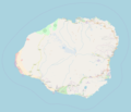
Size of this preview: 697 × 599 pixels. Other resolutions: 279 × 240 pixels | 558 × 480 pixels | 893 × 768 pixels | 1,191 × 1,024 pixels | 1,904 × 1,637 pixels.
Original file (1,904 × 1,637 pixels, file size: 467 KB, MIME type: image/png)
File history
Click on a date/time to view the file as it appeared at that time.
| Date/Time | Thumbnail | Dimensions | User | Comment | |
|---|---|---|---|---|---|
| current | 17:31, 25 October 2017 |  | 1,904 × 1,637 (467 KB) | Mliu92 | Updated with closer view of island. |
| 15:23, 25 October 2017 |  | 2,051 × 1,895 (454 KB) | Mliu92 | User created page with UploadWizard |
File usage
There are no pages that use this file.
Global file usage
The following other wikis use this file:
- Usage on en.wikipedia.org
- Waimea Canyon State Park
- Nā Pali Coast State Park
- Kōkeʻe State Park
- Russian Fort Elizabeth
- Hāʻena State Park
- Polihale State Park
- Wailua River State Park
- Honopū Valley
- Waiʻoli Mission District
- Grove Farm (Lihue, Hawaii)
- Puʻuʻōpae Bridge
- Module:Location map/data/United States Kauai
- Module:Location map/data/United States Kauai/doc
- Kōʻula River
- Hanapēpē River
- Princeville Botanical Gardens
- Usage on fr.wikipedia.org
- Usage on ml.wikipedia.org
- Usage on si.wikipedia.org
- Usage on uz.wikipedia.org
- Usage on zh.wikipedia.org


 Français
 Italiano


