Size of this preview: 608 × 599 pixels. Other resolutions: 244 × 240 pixels | 487 × 480 pixels | 779 × 768 pixels | 1,039 × 1,024 pixels | 2,078 × 2,048 pixels | 2,695 × 2,656 pixels.
Original file (2,695 × 2,656 pixels, file size: 1.36 MB, MIME type: image/png)
File history
Click on a date/time to view the file as it appeared at that time.
| Date/Time | Thumbnail | Dimensions | User | Comment | |
|---|---|---|---|---|---|
| current | 13:44, 22 April 2024 |  | 2,695 × 2,656 (1.36 MB) | Metrophil | fix mistakes and typos, add changes since 2019 |
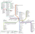
| 16:08, 1 February 2019 |  | 3,556 × 3,779 (1.91 MB) | Metrophil | {{Information |description ={{en|1=Map of Bogestra tram and light rail lines, January 2019 version}} {{de|1=Linienplan Schienennahverkehr Bogestra (Straßen- und Stadtbahn), Version Februar 2019}} |date =2019-02-01 |source =updated version of File:Linienplannetzplan_Schienenverkehr_Bogestra_2017.png |author =User:Yohannos, User:Metrophil |other versions=<gallery> File:Linienplannetzplan Schienenverkehr Bogestra 2015.png|2015 version File:Linienplannetzplan... |
File usage
The following 2 pages use this file:
Global file usage
The following other wikis use this file:
- Usage on cs.wikipedia.org
- Usage on de.wikipedia.org
- Usage on eo.wikipedia.org
- Usage on nl.wikivoyage.org
- Usage on uk.wikipedia.org
- Usage on www.wikidata.org


 Français
 Italiano


