
 Français
 Italiano
Size of this PNG preview of this SVG file: 512 × 453 pixels. Other resolutions: 271 × 240 pixels | 543 × 480 pixels | 868 × 768 pixels | 1,157 × 1,024 pixels | 2,315 × 2,048 pixels.
Original file (SVG file, nominally 512 × 453 pixels, file size: 95 KB)
This is a file from the Wikimedia Commons and may be used by other projects. Information from its description page there is shown below. Commons is a freely licensed media file repository. |
Summary
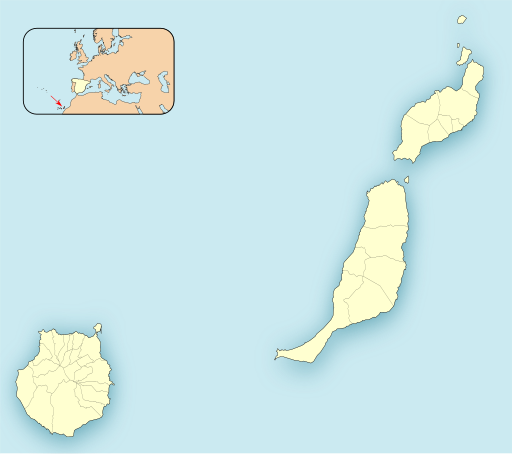
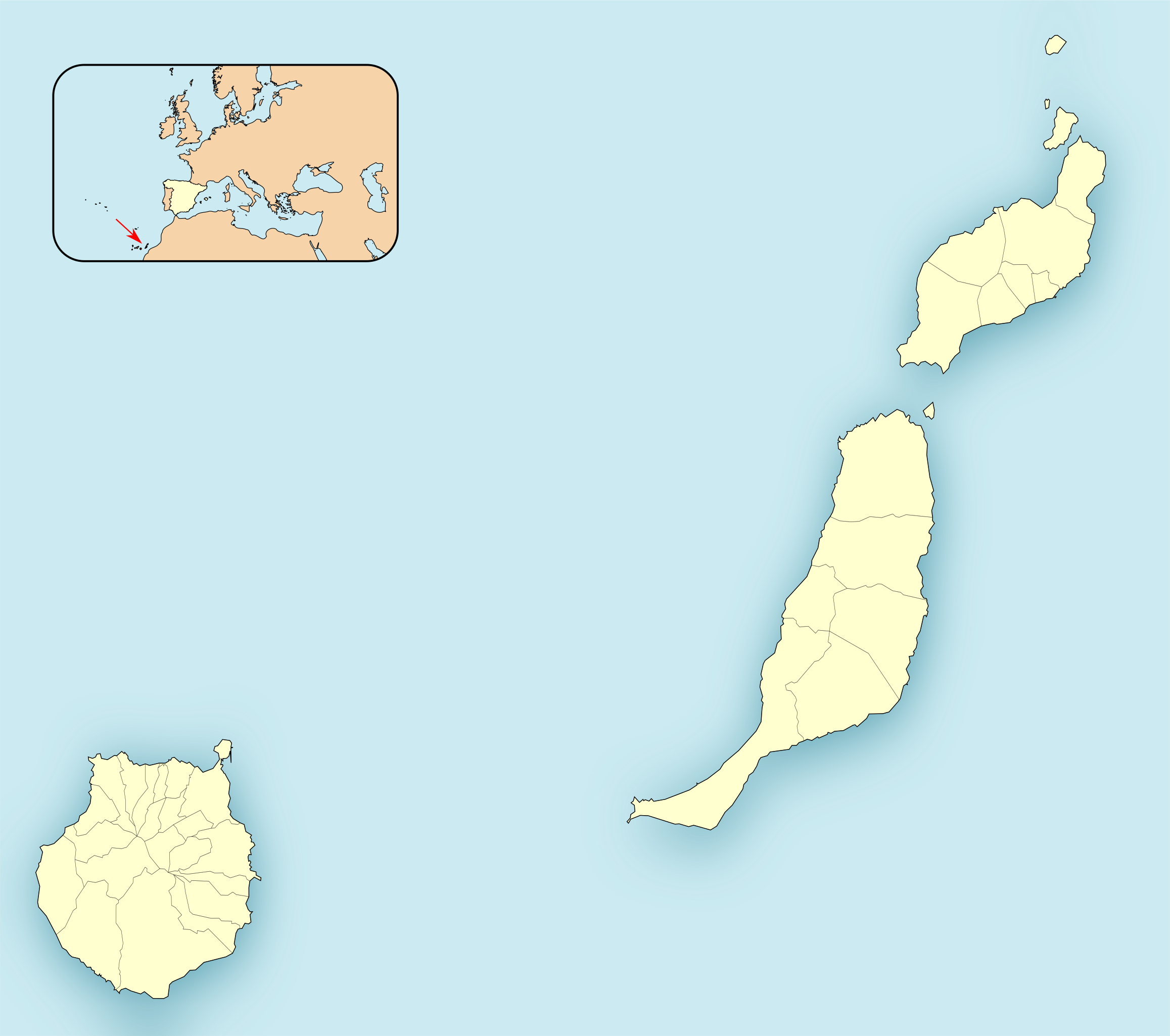
| Description | English: Location map of Province of Las Palmas Equirectangular projection, N/S stretching 130 %. Geographic limits of the map:
Español: Mapa de localización de las Provincia de Las Palmas Proyección equirrectangular (cilíndrica equidistante), N/S estirada 130 %. Límites geográficos del mapa:
| |
| Date | ||
| Source | Own work based on: EspañaLoc.svg by HansenBCN | |
| Author | Miguillen | |
| SVG development | This locator map was created with Inkscape.
|
Licensing
Miguillen, the copyright holder of this work, hereby publishes it under the following license:
This file is licensed under the Creative Commons Attribution-Share Alike 3.0 Unported license.
Attribution: Miguillen
- You are free:
- to share – to copy, distribute and transmit the work
- to remix – to adapt the work
- Under the following conditions:
- attribution – You must give appropriate credit, provide a link to the license, and indicate if changes were made. You may do so in any reasonable manner, but not in any way that suggests the licensor endorses you or your use.
- share alike – If you remix, transform, or build upon the material, you must distribute your contributions under the same or compatible license as the original.
File history
Click on a date/time to view the file as it appeared at that time.
| Date/Time | Thumbnail | Dimensions | User | Comment | |
|---|---|---|---|---|---|
| current | 17:03, 28 July 2020 | | 512 × 453 (95 KB) | Pedro alfred2 | Reverted to version as of 15:34, 21 November 2010 (UTC) |
| 16:15, 10 December 2010 |  | 512 × 453 (53 KB) | Miguillen | mosca con CCAA según convención | |
| 15:34, 21 November 2010 |  | 512 × 453 (95 KB) | Miguillen | estiro un 130 % | |
| 12:10, 21 November 2010 |  | 512 × 362 (96 KB) | Miguillen | == {{int:filedesc}} == {{Information |Description={{en|Location map of Province of Las Palmas}} Equirectangular projection, N/S stretching 130 %. Geographic limits of the map: * N: ° N * S: ° N * W: ° O * E: ° O {{e |
File usage
There are no pages that use this file.
Global file usage
The following other wikis use this file:
- Usage on ar.wikipedia.org
- سانتا لوثيا دي تيراخانا
- سان بارتولومي دي تيراخانا
- أروكاس
- بويرتو ديل روساريو
- إنخينيو
- أغويميس
- غالدار
- موغان
- لا أوليفا
- باخارا
- تيغيسي
- تياس (لاس بالماس)
- سان بارتولومي (لاس بالماس)
- يايثا (لاس بالماس)
- توينيخي
- تيرور (لاس بالماس)
- أنتيغوا (لاس بالماس)
- فالسيكيو دي غران كناريا
- لا ألديا دي سان نيكولاس
- مويا (لاس بالماس)
- فيغا دي سان ماتيو
- فيرغاس
- أغايتي
- تيناخو
- أريا (لاس بالماس)
- فاييسيكو
- تيخيدا
- أرتينارا
- بيتانكوريا
- قالب:Location map Spain Province of Las Palmas
- Usage on ba.wikipedia.org
- Usage on ceb.wikipedia.org
- Usage on el.wikipedia.org
- Usage on en.wikipedia.org
View more global usage of this file.
Metadata
Explore the world

United states
New York

Japan
Tokyo

Singapore
Singapore
