
 Français
 Italiano
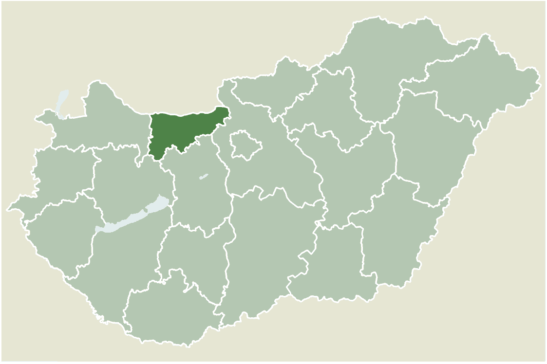
Size of this preview: 800 × 533 pixels. Other resolutions: 320 × 213 pixels | 640 × 426 pixels | 1,123 × 748 pixels.
Original file (1,123 × 748 pixels, file size: 52 KB, MIME type: image/png)
This is a file from the Wikimedia Commons and may be used by other projects. Information from its description page there is shown below. Commons is a freely licensed media file repository. |
Location map for Komárom-Esztergom county, Hungary.
- From: http://hu.wikipedia.org
- Created by: hu:User:Juhasz peter, 2005. július 1.
 | Permission is granted to copy, distribute and/or modify this document under the terms of the GNU Free Documentation License, Version 1.2 or any later version published by the Free Software Foundation; with no Invariant Sections, no Front-Cover Texts, and no Back-Cover Texts. A copy of the license is included in the section entitled GNU Free Documentation License. |
| This file is licensed under the Creative Commons Attribution-Share Alike 3.0 Unported license. | ||
| ||
| This licensing tag was added to this file as part of the GFDL licensing update. |
File history
Click on a date/time to view the file as it appeared at that time.
| Date/Time | Thumbnail | Dimensions | User | Comment | |
|---|---|---|---|---|---|
| current | 08:00, 1 April 2006 | | 1,123 × 748 (52 KB) | Maksim | La bildo estas kopiita de wikipedia:hu. La originala priskribo estas: Komárom-Esztergom megye elhelyezkedése Magyarországon Juhász Péter, 2005. július 1. Saját készítésű térkép {{GFDL}} {| border="1" ! date/time || username || edit su |
File usage
There are no pages that use this file.
Global file usage
The following other wikis use this file:
- Usage on ar.wikipedia.org
- Usage on bg.wikipedia.org
- Usage on da.wikipedia.org
- Usage on en.wikipedia.org
- Bokod, Hungary
- Aka, Hungary
- Almásfüzitő
- Annavölgy
- Ácsteszér
- Ászár
- Bajna, Hungary
- Bakonysárkány
- Bakonyszombathely
- Bana, Hungary
- Bársonyos
- Csatka
- Császár
- Csép
- Csolnok
- Dág, Hungary
- Dunaalmás
- Dad, Hungary
- Dunaszentmiklós
- Epöl
- Ete, Hungary
- Gyermely
- Héreg
- Kisigmánd
- Kocs
- Kesztölc
- Kerékteleki
- Kecskéd
- Kömlőd
- Környe
- Naszály
- Nagysáp
- Nagyigmánd
- Mogyorósbánya
- Mocsa
- Máriahalom
- Leányvár
- Neszmély
- Piliscsév
- Réde
- Sárisáp
- Súr
- Süttő
- Szákszend
- Szomód
- Szomor
- Tát
View more global usage of this file.
Explore the world

United states
New York

Japan
Tokyo

Singapore
Singapore
