
 Français
 Italiano
Size of this PNG preview of this SVG file: 512 × 374 pixels. Other resolutions: 320 × 234 pixels | 640 × 468 pixels | 1,024 × 748 pixels | 1,280 × 935 pixels | 2,560 × 1,870 pixels.
Original file (SVG file, nominally 512 × 374 pixels, file size: 429 KB)
This is a file from the Wikimedia Commons and may be used by other projects. Information from its description page there is shown below. Commons is a freely licensed media file repository. |
Summary
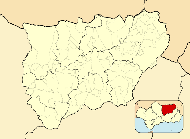
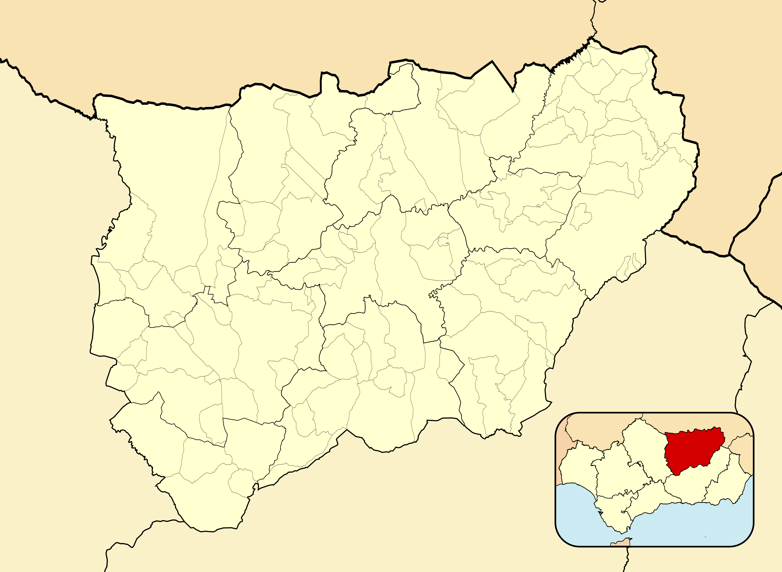
| Description | English: Location map of Province of Jaén Equirectangular projection, N/S stretching 130 %. Geographic limits of the map:
Español: Mapa de localización de Provincia de Jaén Proyección equirrectangular, N/S estirada 130 %. Límites geográficos del mapa:
| |
| Date | ||
| Source | Own work based on: EspañaLoc.svg by HansenBCN and Spain location map.svg by NNW | |
| Author | Miguillen | |
| SVG development | This locator map was created with Inkscape.
|
Licensing
Miguillen, the copyright holder of this work, hereby publishes it under the following license:
This file is licensed under the Creative Commons Attribution-Share Alike 3.0 Unported license.
Attribution: Miguillen
- You are free:
- to share – to copy, distribute and transmit the work
- to remix – to adapt the work
- Under the following conditions:
- attribution – You must give appropriate credit, provide a link to the license, and indicate if changes were made. You may do so in any reasonable manner, but not in any way that suggests the licensor endorses you or your use.
- share alike – If you remix, transform, or build upon the material, you must distribute your contributions under the same or compatible license as the original.
File history
Click on a date/time to view the file as it appeared at that time.
| Date/Time | Thumbnail | Dimensions | User | Comment | |
|---|---|---|---|---|---|
| current | 15:51, 8 December 2010 | | 512 × 374 (429 KB) | Miguillen | colores |
| 12:58, 8 December 2010 |  | 512 × 374 (432 KB) | Miguillen | adapto a nueva convención | |
| 09:19, 10 June 2010 |  | 512 × 374 (336 KB) | Miguillen | == {{int:filedesc}} == {{Information |Description= {{en|Location map of Province of Jaén}} Equirectangular projection, N/S stretching 130 %. Geographic limits of the map: * N: 43.469909° N * S: 41.829151° N * W: 2.625855° |
File usage
There are no pages that use this file.
Global file usage
The following other wikis use this file:
- Usage on ar.wikipedia.org
- Usage on ast.wikipedia.org
- Usage on ba.wikipedia.org
- Usage on ceb.wikipedia.org
- Usage on de.wikipedia.org
- Usage on en.wikipedia.org
- Andújar
- Quesada, Spain
- Bailén
- Porcuna
- Linares, Jaén
- Torreperogil
- Segura de la Sierra
- Albanchez de Mágina
- Alcalá la Real
- Aldeaquemada
- Arjonilla
- Arquillos
- Arroyo del Ojanco
- Baños de la Encina
- Beas de Segura
- Bedmar y Garcíez
- Begíjar
- Bélmez de la Moraleda
- Cabra del Santo Cristo
- Cambil
- Carboneros
- Cárcheles
- La Carolina
- Castillo de Locubín
- Cazalilla
- Chiclana de Segura
- Chilluévar
- Escañuela
- Espeluy
- Fuensanta de Martos
- Fuerte del Rey
- La Guardia de Jaén
- Guarromán
- Hinojares
- Hornos
- Huelma
- Huesa
- La Iruela
- Iznatoraf
- Jabalquinto
- Jamilena
- Jódar
- Lahiguera
View more global usage of this file.
Explore the world

United states
New York

Japan
Tokyo

Singapore
Singapore
