Size of this preview: 718 × 600 pixels. Other resolutions: 287 × 240 pixels | 575 × 480 pixels | 919 × 768 pixels | 1,226 × 1,024 pixels | 1,398 × 1,168 pixels.
Original file (1,398 × 1,168 pixels, file size: 177 KB, MIME type: image/png)
File history
Click on a date/time to view the file as it appeared at that time.
| Date/Time | Thumbnail | Dimensions | User | Comment | |
|---|---|---|---|---|---|
| current | 17:32, 1 September 2016 |  | 1,398 × 1,168 (177 KB) | Number 57 | Updated Israel map |
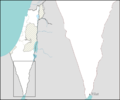
| 21:33, 10 March 2009 |  | 1,398 × 1,168 (38 KB) | Ynhockey | {{Information |Description=Map for southern Israel (Negev Mountain) localities pushpin maps. |Source=self-made |Date=2009-03-10 |Author= Ynhockey |Permission= |other_versions= }} Category:Maps of Israel |
File usage
There are no pages that use this file.
Global file usage
The following other wikis use this file:
- Usage on ar.wikipedia.org
- Usage on bxr.wikipedia.org
- Usage on ca.wikipedia.org
- Usage on el.wikipedia.org
- Usage on en.wikipedia.org
- Eilat
- Sde Boker
- Midreshet Ben-Gurion
- Yotvata
- Mitzpe Ramon
- Ir Ovot
- Paran, Israel
- Eilot
- Ketura, Israel
- Timna Valley
- Lotan, Israel
- Yahel
- Ovda Airbase
- Ramon Airbase
- Neot Smadar
- Yotvata Hai-Bar Nature Reserve
- 2007 Eilat bombing
- Nitzana, Israel
- Ezuz
- Ein Yahav
- Hatzeva
- Idan, Israel
- Tzukim
- Sapir, Israel
- Elifaz, Israel
- Samar, Israel
- Be'er Ora
- Shaharut
- Grofit
- Neve Harif
- Ein Hatzeva
- Module:Location map/data/Israel negev mt/doc
- Ein Ofarim killings
- 2011 southern Israel cross-border attacks
- September 2012 southern Israel cross-border attack
- Lotz Cisterns
- Module:Location map/data/Israel negev mt
- Tzofar
- Shitim
- Shalva BaMidbar
- Usage on es.wikipedia.org
- Usage on fa.wikipedia.org
View more global usage of this file.


 Français
 Italiano


