
 Français
 Italiano
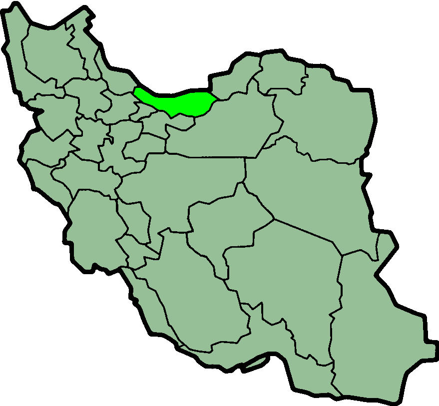
Size of this preview: 648 × 599 pixels. Other resolutions: 260 × 240 pixels | 519 × 480 pixels | 879 × 813 pixels.
Original file (879 × 813 pixels, file size: 25 KB, MIME type: image/png)
This is a file from the Wikimedia Commons and may be used by other projects. Information from its description page there is shown below. Commons is a freely licensed media file repository. |
 | Permission is granted to copy, distribute and/or modify this document under the terms of the GNU Free Documentation License, Version 1.2 or any later version published by the Free Software Foundation; with no Invariant Sections, no Front-Cover Texts, and no Back-Cover Texts. A copy of the license is included in the section entitled GNU Free Documentation License. |
| This file is licensed under the Creative Commons Attribution-Share Alike 3.0 Unported license. | ||
| ||
| This licensing tag was added to this file as part of the GFDL licensing update. |
 | This file has been superseded by IranMazandaran-SVG.svg. It is recommended to use the other file. Please note that deleting superseded images requires consent. |  |
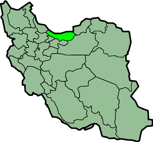
| Description | Province of Mazandaran, Iran Deutsch: Lage der Provinz Mazandaran im Iran Nederlands: Ligging van Mazandaran in Iran |
| Date | (UTC) |
| Source | http://en.wikipedia.org/wiki/Image:IranMazandaran.png |
| Author | Morven |
| Permission (Reusing this file) | GFDL |
File history
Click on a date/time to view the file as it appeared at that time.
| Date/Time | Thumbnail | Dimensions | User | Comment | |
|---|---|---|---|---|---|
| current | 00:02, 24 June 2013 | | 879 × 813 (25 KB) | BasilLeaf | بروزرسانی مرز بین استانهای یزد و خراسان جنوبی، تهران و البرز، فارس و یزد و اصفهان |
| 11:55, 12 November 2010 |  | 879 × 813 (41 KB) | M samadi | Quality improved, Border of some provinces updated. | |
| 13:10, 13 October 2010 |  | 200 × 185 (13 KB) | Amin19850 | Tehran & Alborz Province is divided | |
| 17:10, 8 November 2006 |  | 200 × 185 (11 KB) | Raymond | transparent background, improved color palette | |
| 06:01, 6 September 2005 |  | 200 × 185 (22 KB) | Roozbeh | updated with new Khorasan(s) and expandion of Yazd | |
| 17:42, 29 August 2005 |  | 200 × 185 (20 KB) | Kotoito | Mazandaran, Province of Iran. Image created by en:User:Morwen.{{GFDL}} |
File usage
There are no pages that use this file.
Global file usage
The following other wikis use this file:
- Usage on ar.wikipedia.org
- Usage on az.wikipedia.org
- Usage on bn.wikipedia.org
- Usage on ca.wikipedia.org
- Usage on ckb.wikipedia.org
- Usage on el.wikipedia.org
- Usage on en.wikipedia.org
- Pachet
- Namakab Rud
- Sehri
- Nur, Iran
- Ruyan, Iran
- Alasht
- Yush, Mazandaran
- Shahandasht
- Sarka
- Mahmudabad, Mazandaran
- Juybar
- Haraz River
- Baladeh, Mazandaran
- Niak
- Rineh
- Lashak
- Do Ab (Iran)
- Dasht-e Naz Airport
- Avil
- Galugah, Babol
- Bahnemir
- Marzanabad
- Chamestan
- Kiakola
- Zirab
- Kelarabad
- Nashtarud
- Fereydunkenar
- Larijan District
- Dabudasht
- Gazanak
- Bordun
- Pol-e Sefid, Mazandaran
- User:AlexNebraska/Images of Iran
- Disar
- Amirkola
- Talvat
- Surak, Iran
- Larim
- Kuhi Kheyl
- Dabudasht District
- Galugah
View more global usage of this file.
Metadata
Explore the world

United states
New York

Japan
Tokyo

Singapore
Singapore
