
 Français
 Italiano
Size of this PNG preview of this SVG file: 762 × 600 pixels. Other resolutions: 305 × 240 pixels | 610 × 480 pixels | 976 × 768 pixels | 1,280 × 1,008 pixels | 2,560 × 2,016 pixels | 1,425 × 1,122 pixels.
Original file (SVG file, nominally 1,425 × 1,122 pixels, file size: 1.59 MB)
This is a file from the Wikimedia Commons and may be used by other projects. Information from its description page there is shown below. Commons is a freely licensed media file repository. |
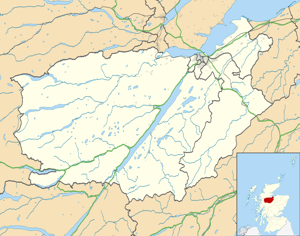
| Description | Map of the Inverness city management area, UK in 2011, with the following information shown:
Equirectangular map projection on WGS 84 datum, with N/S stretched 180% Geographic limits:
|
| Date | |
| Source |
|
| Author | Nilfanion, created using Ordnance Survey data |
| Permission (Reusing this file) | This file is licensed under the Creative Commons Attribution-Share Alike 3.0 Unported license. Attribution: Contains Ordnance Survey data © Crown copyright and database right
|
| Other versions | File:Inverness UK blank map.svg - Blank map |
File history
Click on a date/time to view the file as it appeared at that time.
| Date/Time | Thumbnail | Dimensions | User | Comment | |
|---|---|---|---|---|---|
| current | 01:09, 22 February 2011 | | 1,425 × 1,122 (1.59 MB) | Nilfanion | {{Information |Description=Map of the Inverness city management area, UK in 2011, with the following information shown: *Ward boundaries *Coastline and lakes *Roads and railways *Urban areas Equirectangular map projection on WGS 84 datum, |
File usage
There are no pages that use this file.
Global file usage
The following other wikis use this file:
- Usage on ar.wikipedia.org
- Usage on ceb.wikipedia.org
- Usage on en.wikipedia.org
- Fort Augustus
- Fort George, Highland
- Culloden, Highland
- Urquhart Castle
- Invermoriston
- Caledonian Stadium
- Drumnadrochit
- Merkinch
- Raigmore Hospital
- Cawdor
- Aberarder
- Abriachan
- Achnaconeran
- South Kessock
- Beauly
- Millburn, Inverness
- Smithton, Highland
- Westhill, Highland
- Balloch, Highland
- Tomatin
- Cannich
- Cabrich
- Scorguie
- Tornagrain
- Bught Park
- Balnain
- Ardendrain
- Ardnagrask
- Croy, Highland
- Talk:Smithton, Highland
- Kiltarlity
- Dores, Highland
- Moy, Highland
- Achnabat
- Allanfearn
- Aigas
- Aldourie
- Bunloit
- Foyers, Highland
- Balbeg, Highland
- Bunchrew
- Barnyards, Highland
- Gorthleck
- Crask of Aigas
- Leachkin
- Inverfarigaig
- Camault Muir
- Corrimony
View more global usage of this file.
Explore the world

United states
New York

Japan
Tokyo

Singapore
Singapore
