
 Français
 Italiano
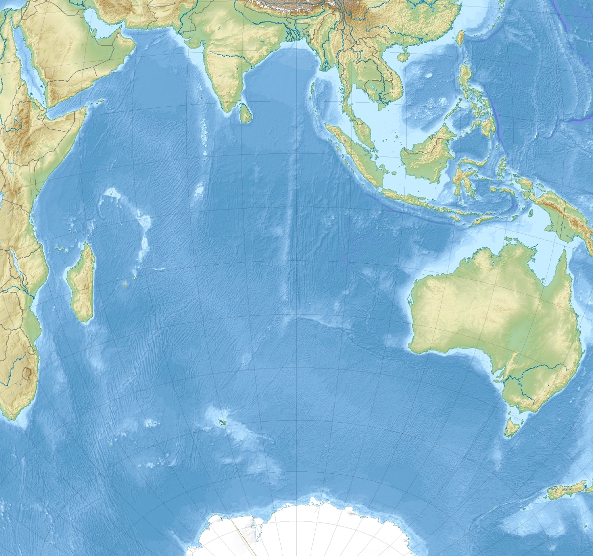
Size of this preview: 638 × 599 pixels. Other resolutions: 256 × 240 pixels | 511 × 480 pixels | 818 × 768 pixels | 1,181 × 1,109 pixels.
Original file (1,181 × 1,109 pixels, file size: 1.14 MB, MIME type: image/jpeg)
This is a file from the Wikimedia Commons and may be used by other projects. Information from its description page there is shown below. Commons is a freely licensed media file repository. |
Summary
| Description | English: Relief location map of Indian Ocean.
|
| Date | |
| Source | Own work |
| Author | Uwe Dedering |
Licensing
I, the copyright holder of this work, hereby publish it under the following licenses:
This file is licensed under the Creative Commons Attribution-Share Alike 3.0 Unported license.
- You are free:
- to share – to copy, distribute and transmit the work
- to remix – to adapt the work
- Under the following conditions:
- attribution – You must give appropriate credit, provide a link to the license, and indicate if changes were made. You may do so in any reasonable manner, but not in any way that suggests the licensor endorses you or your use.
- share alike – If you remix, transform, or build upon the material, you must distribute your contributions under the same or compatible license as the original.
 | Permission is granted to copy, distribute and/or modify this document under the terms of the GNU Free Documentation License, Version 1.2 or any later version published by the Free Software Foundation; with no Invariant Sections, no Front-Cover Texts, and no Back-Cover Texts. A copy of the license is included in the section entitled GNU Free Documentation License. |
You may select the license of your choice.
File history
Click on a date/time to view the file as it appeared at that time.
| Date/Time | Thumbnail | Dimensions | User | Comment | |
|---|---|---|---|---|---|
| current | 11:25, 4 December 2010 | | 1,181 × 1,109 (1.14 MB) | Uwe Dedering | {{Information |Description={{en|1= Relief location map of Indian_Ocean. * Projection: Lambert azimuthal equal-area projection. * Area of interest: :* N: 30.0° N :* S: -70.0° N :* W: 30.0° E :* E: 150.0° E * Projection center: :* NS: -20.0° N :* WE: 9 |
File usage
There are no pages that use this file.
Global file usage
The following other wikis use this file:
- Usage on als.wikipedia.org
- Usage on ar.wikipedia.org
- Usage on ast.wikipedia.org
- Usage on az.wikipedia.org
- Ərəbistan dənizi
- Arafura dənizi
- Timor dənizi
- Şablon:Yer xəritəsi Hind okeanı
- Lakkadiv dənizi
- Kosmonavtlar dənizi
- Ekvatorial keçidi (boğaz)
- Huvadu boğazı
- Sen-Pol adası
- Amsterdam adası
- Zond adaları
- Mouson-Pik
- Biq-Ben (Herd)
- Herd adası və Makdonald adaları
- Maskarin (vulkan)
- Bassas da İndiya adaları
- Qros Morn dağı
- Piton-de-Nej massivi
- Piton-de-Nej dağı
- Piton-de-la-Furnez
- Qloryoz adaları
- Tromelin adası
- Avropa adası
- Bank-du-Qeysir
- Eparse adaları
- Bumeranq (sualtı vulkan)
- Amsterdam vulkanı
- Usage on ba.wikipedia.org
- Usage on be.wikipedia.org
View more global usage of this file.
Metadata
Explore the world

United states
New York

Japan
Tokyo

Singapore
Singapore
