Size of this PNG preview of this SVG file: 530 × 599 pixels. Other resolutions: 212 × 240 pixels | 425 × 480 pixels | 680 × 768 pixels | 906 × 1,024 pixels | 1,812 × 2,048 pixels | 1,639 × 1,852 pixels.
Original file (SVG file, nominally 1,639 × 1,852 pixels, file size: 751 KB)
File history
Click on a date/time to view the file as it appeared at that time.
| Date/Time | Thumbnail | Dimensions | User | Comment | |
|---|---|---|---|---|---|
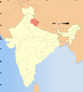
| current | 17:49, 6 August 2006 |  | 1,639 × 1,852 (751 KB) | Planemad | {{WikiProject_India_Maps |Title=Uttaranchal locator map |Description=Locator map of the state of Uttaranchal, India with district boundaries. |Source=. |Date=August 6 2006 |Author=w:user:Nichalpw:user:Planemad |Thumbdir=CHANGE }} |
File usage
There are no pages that use this file.
Global file usage
The following other wikis use this file:
- Usage on ba.wikipedia.org
- Usage on be.wikipedia.org
- Usage on bh.wikipedia.org
- Usage on da.wikipedia.org
- Usage on en.wikipedia.org
- Pindari Glacier
- Milam Glacier
- Ralam Glacier
- Tirsuli
- Chhiplakot
- Namik Glacier
- Hardeol
- Kalabaland Glacier
- Sin La
- Darma Valley
- Nama Pass
- Chopta Valley
- Nagalaphu
- Meola Glacier
- Sona Glacier
- Gaula River (India)
- Rishi Pahar
- Bamba Dhura
- Panchchuli Glacier
- Suj Tilla East
- Gora Padao
- Bandia
- Barkot, Uttarakhand
- Dhandera
- Dharchula Dehat
- Dineshpur
- Dugadda
- Dwarahat
- FRI and College Area
- Gadarpur
View more global usage of this file.


 Français
 Italiano


