
 Français
 Italiano
Size of this PNG preview of this SVG file: 722 × 600 pixels. Other resolutions: 289 × 240 pixels | 578 × 480 pixels | 925 × 768 pixels | 1,233 × 1,024 pixels | 2,465 × 2,048 pixels | 957 × 795 pixels.
Original file (SVG file, nominally 957 × 795 pixels, file size: 1.59 MB)
This is a file from the Wikimedia Commons and may be used by other projects. Information from its description page there is shown below. Commons is a freely licensed media file repository. |
Summary
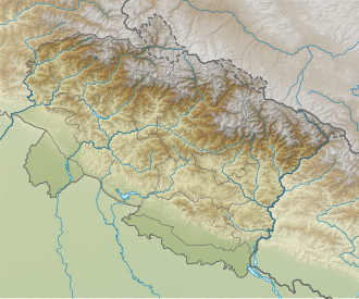
| Description | English: Relief map of Uttarakhand. Elevation data from STRM3. |
| Date | |
| Source | File:India_Uttarakhand_location_map.svg |
| Author | Own work based on Milenoscuro |
Licensing
This file is licensed under the Creative Commons Attribution-Share Alike 4.0 International license.
- You are free:
- to share – to copy, distribute and transmit the work
- to remix – to adapt the work
- Under the following conditions:
- attribution – You must give appropriate credit, provide a link to the license, and indicate if changes were made. You may do so in any reasonable manner, but not in any way that suggests the licensor endorses you or your use.
- share alike – If you remix, transform, or build upon the material, you must distribute your contributions under the same or compatible license as the original.
File history
Click on a date/time to view the file as it appeared at that time.
| Date/Time | Thumbnail | Dimensions | User | Comment | |
|---|---|---|---|---|---|
| current | 03:03, 23 May 2021 | | 957 × 795 (1.59 MB) | C1MM | Corrected districts and river boundaries |
| 04:29, 27 January 2021 |  | 1,245 × 1,122 (1.26 MB) | C1MM | Fixed inaccurate relief and made districts more visible | |
| 05:55, 22 April 2020 |  | 1,245 × 1,122 (2.71 MB) | C1MM | Uploaded a work by Own work based on Milenoscuro from File:India_Uttarakhand_location_map.svg with UploadWizard |
File usage
There are no pages that use this file.
Global file usage
The following other wikis use this file:
- Usage on ar.wikipedia.org
- Usage on as.wikipedia.org
- Usage on ban.wikipedia.org
- Usage on bn.wikipedia.org
- Usage on de.wikipedia.org
- Nanda Devi
- Kamet
- Nanaksagar-Talsperre
- Roopkund Lake
- Trishul (Berg)
- Tehri-Talsperre
- Kishau-Talsperre
- Lakhwar-Talsperre
- Changabang
- Shivling
- Thalay Sagar
- Dunagiri
- Mana (Indien)
- Ghori Parbat
- Mukut Parbat
- Hathi Parbat
- Nanda Ghunti
- Ronti
- Nilkantha
- Nilgiri Parbat
- Barmai
- Kedarnath-Tempel
- Vorlage:Positionskarte Indien Uttarakhand
- Nanda Kot
- Chaukhamba
- Meru (Garhwal)
- Kalanka
- Rishi Pahar
- Hardeol
- Kedarnath (Berg)
- Bhagirathi (Berg)
- Nanda Khat
- Panwali Dwar
- Nanda Gond
- Panchchuli
- Satopanth
- Kalanag (Berg)
- Swargarohini
- Bandarpunchgletscher
- Bandarpunch
- Jaundhar-Bamak-Gletscher
- Nanda Pal
- Milamgletscher
- Indradhanush Parbat
View more global usage of this file.
Metadata
Explore the world

United states
New York

Japan
Tokyo

Singapore
Singapore
