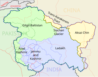
Size of this PNG preview of this SVG file: 543 × 600 pixels. Other resolutions: 217 × 240 pixels | 435 × 480 pixels | 695 × 768 pixels | 927 × 1,024 pixels | 1,855 × 2,048 pixels | 1,574 × 1,738 pixels.
Original file (SVG file, nominally 1,574 × 1,738 pixels, file size: 836 KB)
File history
Click on a date/time to view the file as it appeared at that time.
| Date/Time | Thumbnail | Dimensions | User | Comment | |
|---|---|---|---|---|---|
| current | 07:16, 29 December 2008 |  | 1,574 × 1,738 (836 KB) | Planemad | {{Information |Description= |Source= |Date= |Author= |Permission= |other_versions= }} |
| 17:43, 6 August 2006 |  | 1,639 × 1,852 (751 KB) | Planemad | {{WikiProject_India_Maps |Title=Rajasthan locator map |Description=Locator map of the state of Rajasthan, India with district boundaries. |Source=. |Date=August 6 2006 |Author=w:user:Nichalpw:user:Planemad |Thumbdir=CHANGE }} |
File usage
There are no pages that use this file.
Global file usage
The following other wikis use this file:
- Usage on as.wikipedia.org
- Usage on ba.wikipedia.org
- Usage on be-tarask.wikipedia.org
- Usage on be.wikipedia.org
- Usage on bg.wikipedia.org
- Usage on bh.wikipedia.org
- Usage on bn.wikipedia.org
- বালি, রাজস্থান
- নোখা
- ১ এসজিএম
- ছাবরা
- ছাপার
- ছিপাবারোদ
- ছোটি সাদ্রি
- চিরাওয়া
- চিতোরগড়
- চোমু
- চুরু
- দারিবা, রাজস্থান
- আলোয়ার
- দৌসা
- ডিগ (রাজস্থান)
- দেশনোকে
- দেবগড়, রাজস্থান
- ধারিয়াওয়াদ
- ঢোলপুর
- আবু সড়ক
- দিদওয়ানা
- দুঙ্গারগড়
- দুঙ্গারপুর
- ফতেহনগর
- ফতেহপুর
- আমেত
- গজসিংহপুর
- গালিয়াকোট
- শ্রীগঙ্গানগর
- গঙ্গাপুর (ভিলওয়ারা)
- গঙ্গাপুর সিটি
- গোরেডি চাঁচা
- গোথারা
- গুলাবপুরা
- হনুমানগড়
- হিন্দাউন
- ইন্দ্রগড়
- জাহাজপুর
- জয়সলমের
- জয়তারান
- জালোর
- ঝালাওয়াড়
View more global usage of this file.


 Français
 Italiano


