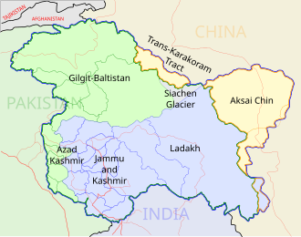
Size of this PNG preview of this SVG file: 543 × 600 pixels. Other resolutions: 217 × 240 pixels | 435 × 480 pixels | 695 × 768 pixels | 927 × 1,024 pixels | 1,855 × 2,048 pixels | 1,574 × 1,738 pixels.
Original file (SVG file, nominally 1,574 × 1,738 pixels, file size: 836 KB)
File history
Click on a date/time to view the file as it appeared at that time.
| Date/Time | Thumbnail | Dimensions | User | Comment | |
|---|---|---|---|---|---|
| current | 07:09, 29 December 2008 |  | 1,574 × 1,738 (836 KB) | Planemad | {{Information |Description= |Source= |Date= |Author= |Permission= |other_versions= }} |
| 17:41, 6 August 2006 |  | 1,639 × 1,852 (751 KB) | Planemad | {{WikiProject_India_Maps |Title=Orissa locator map |Description=Locator map of the state of Orissa, India with district boundaries. |Source=. |Date=August 6 2006 |Author=w:user:Nichalpw:user:Planemad |Thumbdir=CHANGE }} |
File usage
There are no pages that use this file.
Global file usage
The following other wikis use this file:
- Usage on as.wikipedia.org
- Usage on ba.wikipedia.org
- Usage on be.wikipedia.org
- Usage on bg.wikipedia.org
- Usage on bn.wikipedia.org
- Usage on br.wikipedia.org
- Usage on cdo.wikipedia.org
- Usage on ceb.wikipedia.org
- Usage on da.wikipedia.org
- Usage on en.wikipedia.org
- Kadampara
- Utkal Plains
- Jagatpur, India
- Konark Beach
- Bamra State
- Template:Odisha-geo-stub
- Baisipalli Wildlife Sanctuary
- Panikoili
- Hirakud
- Balagoda
- Balimela
- Balugaon
- Bangura, India
- Belagachhia
- Byasanagar
- Chandapur
- Chandili
- Charbatia
- Dadhapatna
- Daitari
- Deracolliery Township
- Dungamal
- Fertilizer Corporation of India Township
- G. Udayagiri
- Ghantapada
- Hatibandha
- Jatani
- Jhumpura
- Kantilo
- Kashinagara
- Khaliapali
- Khariar Road
- Khatiguda
- Kotpad
- Lapanga
- Lattikata
- Makundapur
- Nuapatna
- OCL Industrial Township
- Panposh
- Pratapsasan
View more global usage of this file.


 Français
 Italiano


