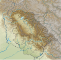
Size of this PNG preview of this SVG file: 612 × 599 pixels. Other resolutions: 245 × 240 pixels | 490 × 480 pixels | 785 × 768 pixels | 1,046 × 1,024 pixels | 2,092 × 2,048 pixels | 757 × 741 pixels.
Original file (SVG file, nominally 757 × 741 pixels, file size: 1.98 MB)
File history
Click on a date/time to view the file as it appeared at that time.
| Date/Time | Thumbnail | Dimensions | User | Comment | |
|---|---|---|---|---|---|
| current | 15:19, 11 July 2022 |  | 757 × 741 (1.98 MB) | C1MM | Uploaded a work by Own work based on user:NordNordWest from Derivative of File:India Jammu and Kashmir UT adm location map.svg with UploadWizard |
File usage
There are no pages that use this file.
Global file usage
The following other wikis use this file:
- Usage on de.wikipedia.org
- Baglihar-Talsperre
- Dal-See
- Ranjit-Sagar-Talsperre
- Kolahoi
- Kolahoigletscher
- Sickle Moon
- Brammah I
- Brammah II
- Haramukh
- Kishtwar Kailash
- Kishtwar Shivling
- Hagshu
- Cerro Kishtwar
- Gadsar Lake
- Konsarnag
- Krishansar Lake
- Gangbal Lake
- Salal-Talsperre
- Dul-Hasti-Talsperre
- Uri-I-Talsperre
- Uri-II-Talsperre
- Lower-Jhelum-Staustufe
- Vorlage:Positionskarte Indien Jammu und Kashmir
- Jawahar-Tunnel
- Pir Panjal Railway Tunnel
- Dr. Syama Prasad Mookerjee Tunnel
- Banihal Qazigund Road Tunnel
- Usage on en.wikipedia.org
- Udhampur
- Dal Lake
- Amarnath Temple
- Banihal Pass
- Wular Lake
- Dachigam National Park
- Hazratbal Shrine
- Jamia Masjid, Srinagar
- Bijbehara
- Baglihar Dam
- Tral
- Salal Dam
- Poonch (town)
- Brammah
- Hari Parbat
- Harmukh
- Manasbal Lake
- Mansar Lake
- Zoji La
- Gangabal Lake
- Gadsar Lake
- Kishanganga Hydroelectric Project
- Vishansar Lake
View more global usage of this file.


 Français
 Italiano


