
 Français
 Italiano
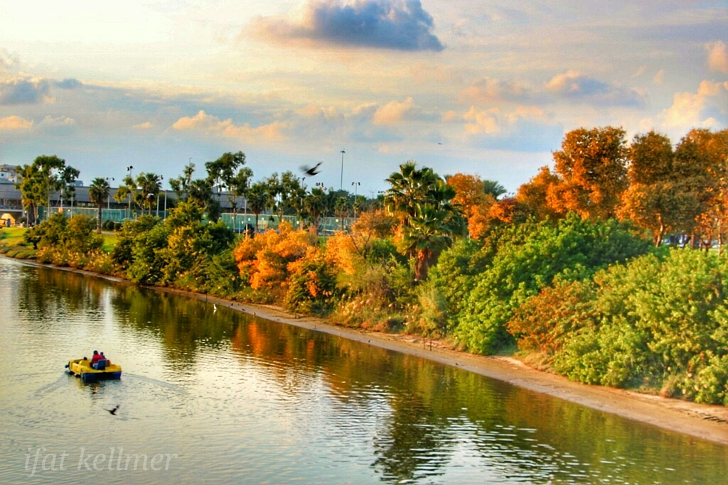
Size of this preview: 800 × 534 pixels. Other resolutions: 320 × 213 pixels | 640 × 427 pixels | 1,024 × 683 pixels.
Original file (1,024 × 683 pixels, file size: 564 KB, MIME type: image/jpeg)
This is a file from the Wikimedia Commons and may be used by other projects. Information from its description page there is shown below. Commons is a freely licensed media file repository. |
Summary
| Description | עברית: נחל הירקון הוא הנחל הגדול ביותר במערכת נחלי החוף של ארץ ישראל. בעת העתיקה התקיימו מספר נקודות התיישבות לאורך הירקון, בהם תל אפק, מגדל אפק, תל גריסה, תל קסילה, גבעת בית המטבחיים ותל כודאדי בשפך הירקון. שפך הירקון לים היווה באותה תקופה נקודת עגינה נוחה לסירות. באותה תקופה חלף אפיקו של הירקון צפונה למיקומו הנוכחי, על שדרות רוקח של ימינו, למרגלות תל קסילה.
| ||
| Date | |||
| Source | Own work | ||
| Author | Ifat kellmer |
| Camera location | | View this and other nearby images on: OpenStreetMap |
|---|
Licensing
I, the copyright holder of this work, hereby publish it under the following license:
This file is licensed under the Creative Commons Attribution-Share Alike 4.0 International license.
- You are free:
- to share – to copy, distribute and transmit the work
- to remix – to adapt the work
- Under the following conditions:
- attribution – You must give appropriate credit, provide a link to the license, and indicate if changes were made. You may do so in any reasonable manner, but not in any way that suggests the licensor endorses you or your use.
- share alike – If you remix, transform, or build upon the material, you must distribute your contributions under the same or compatible license as the original.
 | This image was uploaded as part of Wiki Loves Monuments 2016.
|  |
File history
Click on a date/time to view the file as it appeared at that time.
| Date/Time | Thumbnail | Dimensions | User | Comment | |
|---|---|---|---|---|---|
| current | 09:35, 26 October 2016 | | 1,024 × 683 (564 KB) | Ifatke | User created page with UploadWizard |
File usage
There are no pages that use this file.
Global file usage
The following other wikis use this file:
- Usage on en.wikipedia.org
Metadata
Explore the world

United states
New York

Japan
Tokyo

Singapore
Singapore
