
 Français
 Italiano
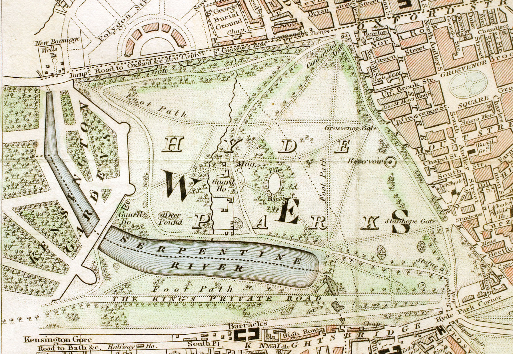
Size of this preview: 800 × 552 pixels. Other resolutions: 320 × 221 pixels | 640 × 442 pixels | 1,024 × 707 pixels | 1,280 × 884 pixels | 1,796 × 1,240 pixels.
Original file (1,796 × 1,240 pixels, file size: 956 KB, MIME type: image/jpeg)
This is a file from the Wikimedia Commons and may be used by other projects. Information from its description page there is shown below. Commons is a freely licensed media file repository. |
Summary
| Description | English: Hyde Park section of "Improved map of London for 1833, from Actual Survey. Engraved by W. Schmollinger, 27 Goswell Terrace", photographed for Wikipedia by User:Pointillist. All rights of the photographer are hereby released. |
| Date | |
| Source | http://en.wikipedia.org/wiki/Image:Hyde_Park_London_from_1833_Schmollinger_map.jpg |
| Creator | |
| Permission (Reusing this file) | original text: {{PD-art}} |
| Georeferencing |
Licensing
| This work is in the public domain in its country of origin and other countries and areas where the copyright term is the author's life plus 70 years or fewer. | |
| This file has been identified as being free of known restrictions under copyright law, including all related and neighboring rights. | |
File history
Click on a date/time to view the file as it appeared at that time.
| Date/Time | Thumbnail | Dimensions | User | Comment | |
|---|---|---|---|---|---|
| current | 14:56, 15 July 2008 | | 1,796 × 1,240 (956 KB) | Ksanyi | {{Information |Description={{en|1=Hyde Park section of "Improved map of London for 1833, from Actual Survey. Engraved by W. Schmollinger, 27 Goswell Terrace", photographed for Wikipedia by User:Pointillist. All rights of the photographer are hereby re |
File usage
There are no pages that use this file.
Global file usage
The following other wikis use this file:
- Usage on ca.wikipedia.org
- Usage on de.wikipedia.org
- Usage on en.wikipedia.org
- Usage on es.wikipedia.org
- Usage on et.wikipedia.org
- Usage on eu.wikipedia.org
- Usage on fa.wikipedia.org
- Usage on fr.wikipedia.org
- Usage on hu.wikipedia.org
- Usage on ms.wikipedia.org
- Usage on ru.wikipedia.org
- Usage on sl.wikipedia.org
- Usage on tr.wikipedia.org
- Usage on www.wikidata.org
- Usage on zh.wikipedia.org
Metadata
Explore the world

United states
New York

Japan
Tokyo

Singapore
Singapore
