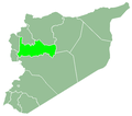
Hama-map.png (672 × 594 pixels, file size: 10 KB, MIME type: image/png)
File history
Click on a date/time to view the file as it appeared at that time.
| Date/Time | Thumbnail | Dimensions | User | Comment | |
|---|---|---|---|---|---|
| current | 22:43, 18 July 2014 |  | 672 × 594 (10 KB) | OgreBot | (BOT): Reverting to most recent version before archival |
| 22:43, 18 July 2014 |  | 672 × 594 (20 KB) | OgreBot | (BOT): Uploading old version of file from en.wikipedia; originally uploaded on 2006-03-30 00:08:20 by LittleDan | |
| 00:21, 18 July 2014 |  | 672 × 594 (10 KB) | Zaher.Kadour | Transferred from en.wikipedia |
File usage
There are no pages that use this file.
Global file usage
The following other wikis use this file:
- Usage on ar.wikipedia.org
- مصياف
- حماة
- البياضية (حماة)
- محافظة حماة
- المحروسة
- السلمية (سوريا)
- كفر بهم
- تل الدرة
- محردة
- عقارب (حماة)
- مورك
- أفاميا
- صوران
- عقرب (حماة)
- شيزر
- طيبة الإمام
- قلعة المضيق
- شلالات البيضا
- وادي العيون
- نهر البارد (حماة)
- كفرزيتا
- اللطامنة
- السقيلبية
- منطقة مركز حماة
- تين سبيل
- الديرون (حماة)
- سلحب
- حي الجراجمة (حماة)
- حورات عمورين
- عين الكروم
- أبو قبيس
- رشي
- منطقة السقيلبية
- ناحية سلحب
- تل دبين
- الزيرة (حماة)
- السويدة
- سيغاتا
- الزاملية
- قصية
- الحوائق
- أصيلة (حماة)
- بقصقص
- سهل العشارنة
- قرمص
- قالب:محافظة حماة
- حلفايا
- مستخدم:German arabic teaching sami/Syria Portal Project 01
- زغرين
- صبورة (سلمية)
View more global usage of this file.


 Français
 Italiano


