
 Français
 Italiano
Size of this preview: 773 × 599 pixels. Other resolutions: 310 × 240 pixels | 619 × 480 pixels | 991 × 768 pixels | 1,280 × 992 pixels | 2,560 × 1,985 pixels | 5,334 × 4,135 pixels.
Original file (5,334 × 4,135 pixels, file size: 7.95 MB, MIME type: image/jpeg)
This is a file from the Wikimedia Commons and may be used by other projects. Information from its description page there is shown below. Commons is a freely licensed media file repository. |
Summary
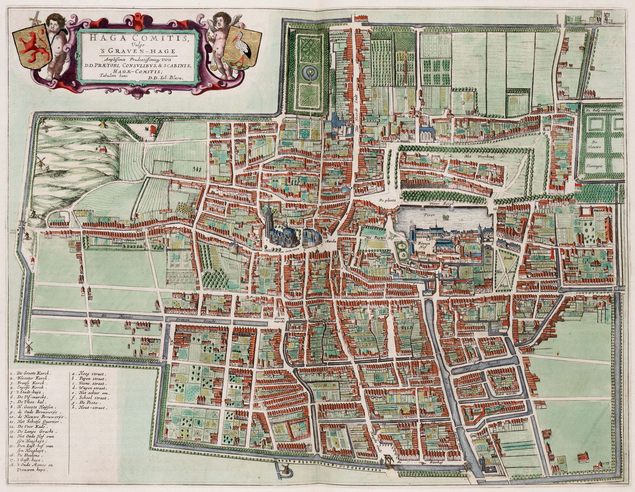
| Description | English: Map of Den Haag | ||||||||||||||||||||||||||
| Date | |||||||||||||||||||||||||||
| Source | Atlas van Loon | ||||||||||||||||||||||||||
| Author |
| ||||||||||||||||||||||||||
.jpg)
.jpg)
Licensing
| This is a faithful photographic reproduction of a two-dimensional, public domain work of art. The work of art itself is in the public domain for the following reason:
The official position taken by the Wikimedia Foundation is that "faithful reproductions of two-dimensional public domain works of art are public domain". This photographic reproduction is therefore also considered to be in the public domain in the United States. In other jurisdictions, re-use of this content may be restricted; see Reuse of PD-Art photographs for details. | ||||
File history
Click on a date/time to view the file as it appeared at that time.
| Date/Time | Thumbnail | Dimensions | User | Comment | |
|---|---|---|---|---|---|
| current | 07:03, 26 January 2013 | | 5,334 × 4,135 (7.95 MB) | Slick-o-bot | Bot: convert to a non-interlaced jpeg (see bug #17645) |
| 22:24, 21 October 2009 |  | 5,334 × 4,135 (7.75 MB) | Kweniston | {{Information |Description={{en|1=Map of Den Haag}} |Source=Atlas van Loon |Author=unknown |Date=1649 |Permission= |other_versions= }} Category:Old maps of The Hague Category:Atlas van Loon |
File usage
There are no pages that use this file.
Global file usage
The following other wikis use this file:
- Usage on de.wikipedia.org
- Usage on en.wikipedia.org
- Usage on eo.wikipedia.org
- Usage on fr.wikipedia.org
- Usage on is.wikipedia.org
- Usage on nl.wikipedia.org
- Usage on zh.wikipedia.org
Metadata
.jpg)
Explore the world

United states
New York

Japan
Tokyo

Singapore
Singapore
