
 Français
 Italiano
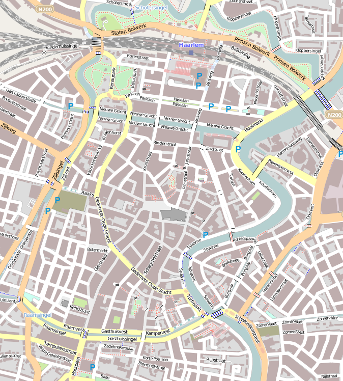
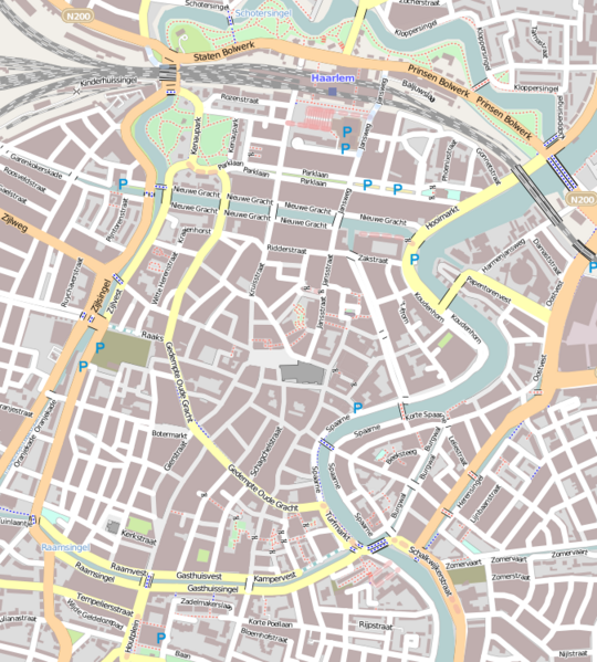
Size of this preview: 540 × 599 pixels. Other resolutions: 216 × 240 pixels | 432 × 480 pixels | 674 × 748 pixels.
Original file (674 × 748 pixels, file size: 408 KB, MIME type: image/png)
This is a file from the Wikimedia Commons and may be used by other projects. Information from its description page there is shown below. Commons is a freely licensed media file repository. |
Summary
| Description | English: Map of Haarlem Geographic limits of the map:
This file is licensed under the Creative Commons Attribution-Share Alike 2.0 Generic license.
|
| Date | |
| Source | OpenStreetMap |
| Author | Jane023 (talk) 15:47, 27 January 2011 (UTC) |
Licensing
I, the copyright holder of this work, hereby publish it under the following license:
This file is licensed under the Creative Commons Attribution-Share Alike 3.0 Unported license.
- You are free:
- to share – to copy, distribute and transmit the work
- to remix – to adapt the work
- Under the following conditions:
- attribution – You must give appropriate credit, provide a link to the license, and indicate if changes were made. You may do so in any reasonable manner, but not in any way that suggests the licensor endorses you or your use.
- share alike – If you remix, transform, or build upon the material, you must distribute your contributions under the same or compatible license as the original.
File history
Click on a date/time to view the file as it appeared at that time.
| Date/Time | Thumbnail | Dimensions | User | Comment | |
|---|---|---|---|---|---|
| current | 15:47, 27 January 2011 | | 674 × 748 (408 KB) | Jane023 | {{Information |Description={{en|1=Map of Haarlem Geographic limits of the map: * N: 52.39015° * S: 52.37407° * W: 4.62487° * E: 4.64933° {{CC-BY-SA 2.0}} }} |Source=[http://www.openstreetmap.org/?lat=52.38211&lon=4.6371&zoom=15&layers=M OpenStree |
File usage
There are no pages that use this file.
Global file usage
The following other wikis use this file:
- Usage on ar.wikipedia.org
- Usage on ca.wikipedia.org
- Usage on ceb.wikipedia.org
- Usage on en.wikipedia.org
- Teylers Museum
- Vleeshal
- Hofje van Bakenes
- Hofje van Noblet
- Frans Loenenhofje
- Lutherse Hofje
- Hofje van Staats
- Hofje van Loo
- Teylers Hofje
- Hofje In den Groenen Tuin
- Hofjes in Haarlem
- Wijnbergshofje
- Grote Markt (Haarlem)
- Vrouwe- en Antonie Gasthuys
- Hofje van Oorschot
- Module:Location map/data/Netherlands Haarlem/doc
- Johan Enschedé Hof
- Bakenesserkerk
- St. Barbara Gasthuis
- Module:Location map/data/Netherlands Haarlem
- Usage on eo.wikipedia.org
- Usage on fa.wikipedia.org
- Usage on fr.wikipedia.org
- Usage on fy.wikipedia.org
- Usage on ig.wikipedia.org
- Usage on kn.wikipedia.org
- Usage on nl.wikipedia.org
View more global usage of this file.
Explore the world

United states
New York

Japan
Tokyo

Singapore
Singapore
