
 Français
 Italiano
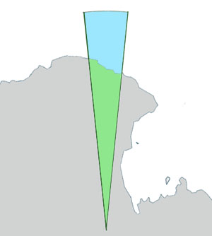
No higher resolution available.
GeorgeVLandstubmap.jpg (300 × 334 pixels, file size: 43 KB, MIME type: image/jpeg)
This is a file from the Wikimedia Commons and may be used by other projects. Information from its description page there is shown below. Commons is a freely licensed media file repository. |
Summary
| Description | English: Outline map of George V Land, Antarctica. |
| Date | |
| Source | This file was derived from: Antarctica, territorial claims.svg |
| Author | Lokal_Profil, DooFi Grutness |
 | This map image could be re-created using vector graphics as an SVG file. This has several advantages; see Commons:Media for cleanup for more information. If an SVG form of this image is available, please upload it and afterwards replace this template with {{vector version available|new image name}}.It is recommended to name the SVG file “GeorgeVLandstubmap.svg”—then the template Vector version available (or Vva) does not need the new image name parameter. |


Licensing
This file is licensed under the Creative Commons Attribution-Share Alike 2.5 Generic license.
- You are free:
- to share – to copy, distribute and transmit the work
- to remix – to adapt the work
- Under the following conditions:
- attribution – You must give appropriate credit, provide a link to the license, and indicate if changes were made. You may do so in any reasonable manner, but not in any way that suggests the licensor endorses you or your use.
- share alike – If you remix, transform, or build upon the material, you must distribute your contributions under the same or compatible license as the original.
Original upload log
The original description page was here. All following user names refer to en.wikipedia.
| Date/Time | Dimensions | User | Comment |
|---|---|---|---|
| 2011-07-07 10:47 | 300×334× (43572 bytes) | Grutness | Outline map of George V Land, Antarctica. Generated from [[:File:Antarctica,_territorial_claims.svg]] ({{cc-by-sa-2.5|[[:User:Lokal_Profil|Lokal_Profil]]}}) by myself ([[User:Grutness]]) |
File history
Click on a date/time to view the file as it appeared at that time.
| Date/Time | Thumbnail | Dimensions | User | Comment | |
|---|---|---|---|---|---|
| current | 17:42, 7 December 2018 | | 300 × 334 (43 KB) | Croomfolk | Transferred from en.wikipedia via #commonshelper |
File usage
There are no pages that use this file.
Global file usage
The following other wikis use this file:
- Usage on en.wikipedia.org
- Point Alden
- Commonwealth Bay
- Fletcher Islands
- Fletcher Island
- Ninnis Glacier
- Fisher Bay
- Buckley Bay (Antarctica)
- Cape Freshfield
- Cook Ice Shelf
- George V Coast
- Mawson Peninsula
- George V Land
- Zélée Subglacial Trench
- Aurora Peak
- Ainsworth Bay, Antarctica
- Wilkes Basin
- Cape Bage
- Blair Islands
- Cape-Pigeon Rocks
- Close Islands
- Organ Pipe Cliffs
- Watt Bay
- Way Archipelago
- Webb Subglacial Trench
- Cape Webb
- Whetter Nunatak
- Correll Nunatak
- Cape De la Motte
- Deakin Bay
- Cape Wild
- Stillwell Island
- Murphy Bay
- Dixson Island
- Doolette Bay
- Douanier Rock
- Cape Pollock
- Garnet Point
- Cape Gray
- Greater Mackellar Island
- Moyes Islands
- Hannam Islands
- McLean Nunataks
- Hodgeman Islands
- Mount Hunt (Antarctica)
- Cape Hunter
- Cape Hurley
- Mackellar Islands
- Madigan Nunatak
- Southern Cross Subglacial Highlands
- Horn Bluff
View more global usage of this file.
Metadata
Explore the world

United states
New York

Japan
Tokyo

Singapore
Singapore
