
 Français
 Italiano
Size of this PNG preview of this SVG file: 484 × 600 pixels. Other resolutions: 194 × 240 pixels | 387 × 480 pixels | 620 × 768 pixels | 826 × 1,024 pixels | 1,653 × 2,048 pixels | 485 × 601 pixels.
Original file (SVG file, nominally 485 × 601 pixels, file size: 101 KB)
This is a file from the Wikimedia Commons and may be used by other projects. Information from its description page there is shown below. Commons is a freely licensed media file repository. |
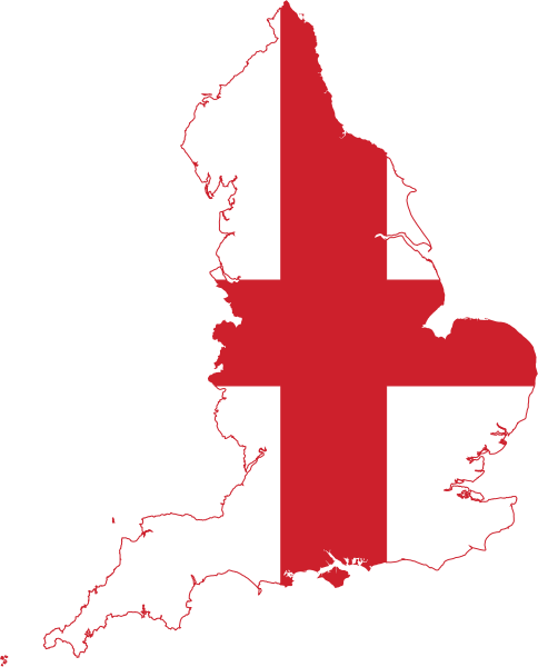
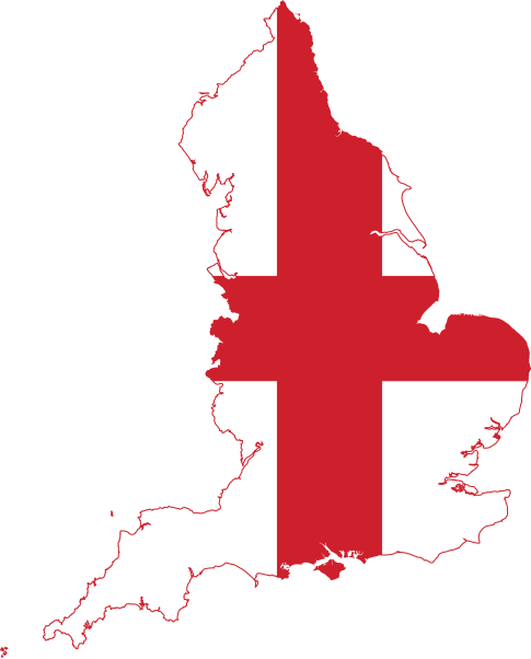
| Description | Flag Map of England |
| Date | (UTC) |
| Source | |
| Author |
|
This file is licensed under the Creative Commons Attribution-Share Alike 3.0 Unported license.
- You are free:
- to share – to copy, distribute and transmit the work
- to remix – to adapt the work
- Under the following conditions:
- attribution – You must give appropriate credit, provide a link to the license, and indicate if changes were made. You may do so in any reasonable manner, but not in any way that suggests the licensor endorses you or your use.
- share alike – If you remix, transform, or build upon the material, you must distribute your contributions under the same or compatible license as the original.
Uploaded with derivativeFX
File history
Click on a date/time to view the file as it appeared at that time.
| Date/Time | Thumbnail | Dimensions | User | Comment | |
|---|---|---|---|---|---|
| current | 23:19, 13 July 2016 | | 485 × 601 (101 KB) | Stasyan117 | +smaller islands |
| 17:41, 1 May 2016 |  | 518 × 640 (41 KB) | BurritoBazooka | (minor) adjust colour ever so slightly to be the same as the Flag of England file | |
| 16:52, 1 May 2016 |  | 518 × 640 (41 KB) | BurritoBazooka | make page a little smaller (in pixels) | |
| 16:45, 1 May 2016 |  | 525 × 650 (45 KB) | BurritoBazooka | clean up unused defs | |
| 15:52, 1 May 2016 |  | 525 × 650 (292 KB) | BurritoBazooka | forgot to delete some cruft outside the page limit | |
| 15:49, 1 May 2016 |  | 525 × 650 (323 KB) | BurritoBazooka | include islands which fall under England's administrative region, such as Isle of Wight. Reproduced from the regions map, and the flag shape used in this image. | |
| 10:48, 21 June 2014 |  | 448 × 595 (83 KB) | AnonMoos | simplify | |
| 20:50, 25 January 2011 |  | 699 × 930 (103 KB) | Fry1989 | {{Information |Description=Flag Map of England |Source=*File:Flag_of_England.svg *File:England_location_map.svg |Date=2011-01-25 20:41 (UTC) |Author=*File:Flag_of_England.svg: *File:England_location_map.svg: *[[:File:United_Kingdo |
File usage
There are no pages that use this file.
Global file usage
The following other wikis use this file:
- Usage on ar.wikipedia.org
- باث
- كانتربيري
- نورتش
- هيستينغز
- دوفر
- نوتنغهام
- كنت
- مقاطعة سومرست (إنجلترا)
- ديفون
- كورنوال
- لنكولنشاير
- نورفك
- أكسفوردشير
- نورثمبرلاند
- إسكس
- سوفولك
- شرق ساسكس
- غرب ساسكس
- جنوب يوركشير
- دورست
- غلوسترشير
- باركشير
- بيدفوردشير
- باكينغهامشير
- هايغيت (لندن)
- سانت ألبانز
- نابتون
- ميدريج
- بيدفورد
- أولني
- بروسلي
- كينغزبري
- هولوواي (لندن)
- تاين ووير
- نهر كام
- تريسكو
- بوسطن (إنجلترا)
- جزر القناة الإنجليزية
- وركشير
- ساسكس
- كان (إنجلترا)
- مانشستر الكبرى
- يوركشاير
- قالب:بذرة جغرافيا إنجلترا
- ويسبري (ويلتشاير)
- واتن
- نوتنغهامشير
- براد اون افون
- تشبنهام
- بارنسلي
View more global usage of this file.
Metadata
Explore the world

United states
New York

Japan
Tokyo

Singapore
Singapore
