
 Français
 Italiano
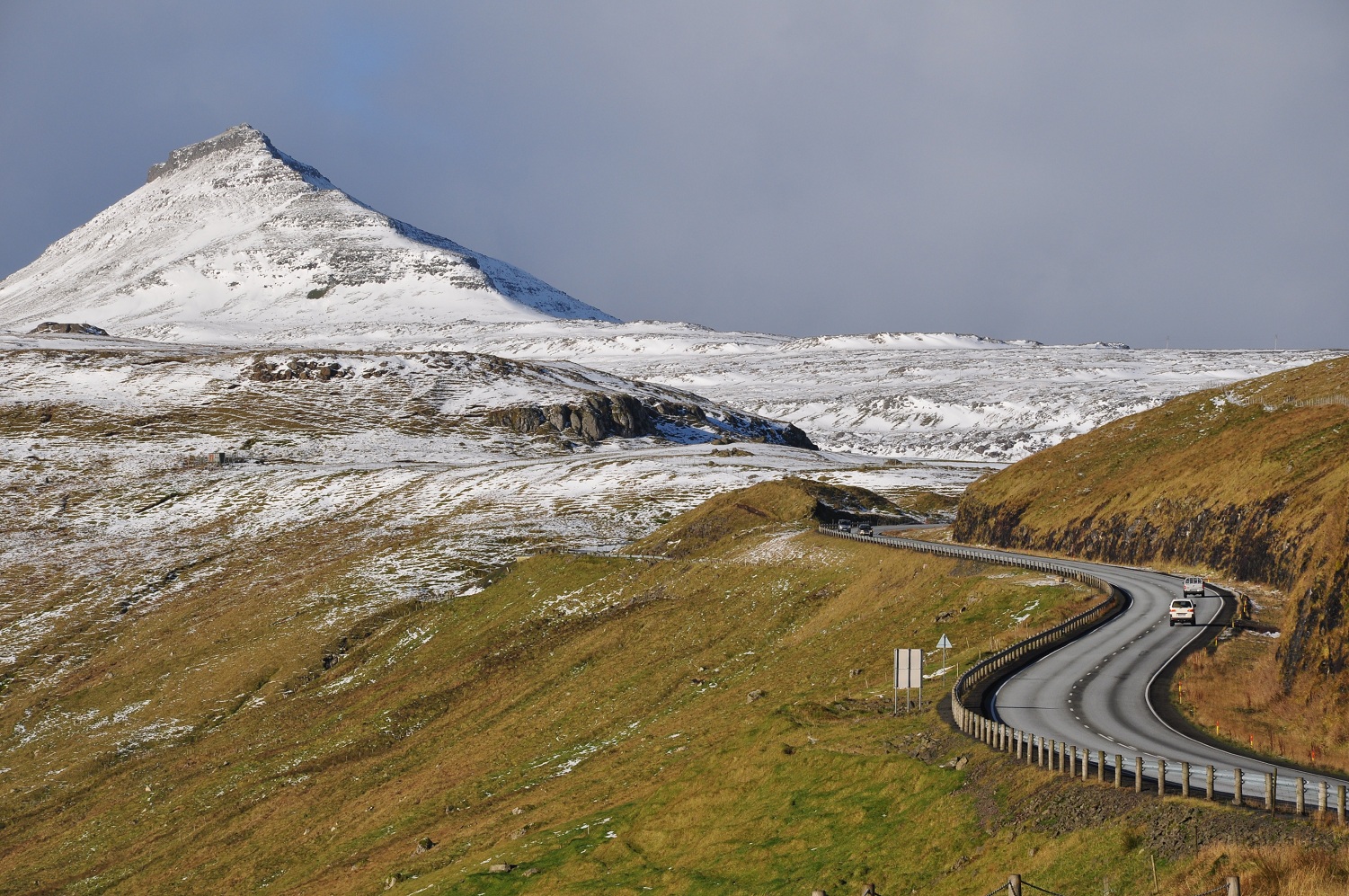
Size of this preview: 800 × 531 pixels. Other resolutions: 320 × 213 pixels | 640 × 425 pixels | 1,024 × 680 pixels | 1,501 × 997 pixels.
Original file (1,501 × 997 pixels, file size: 710 KB, MIME type: image/jpeg)
This is a file from the Wikimedia Commons and may be used by other projects. Information from its description page there is shown below. Commons is a freely licensed media file repository. |
Summary
| Description | English: The road network on the Faroe Islands is excellent, considering the small number of people living there. Six of the main islands are connected by tunnels, bridges and dams. Shown is the road from Skipanes and Soldarfjordur to Syðrugøta on the island Eysturoy. Nederlands: Het wegennet op de Faeroer eilanden is uitstekend. Zes eilanden zijn onderling verbonden met tunnels, bruggen en dammen, en ook op de eilanden zelf zijn lange tunnels gegraven voor het bereikbaar maken van piepkleine dorpen. Op de foto de weg van Skipanes en Soldarfjordur naar Syðrugøta op het eiland Eysturoy. |
| Date | Taken on 22 October 2010 |
| Source | Own work |
| Author | Vincent van Zeijst (talk · contribs) |
| Camera location | | View this and other nearby images on: OpenStreetMap |
|---|
Licensing
I, the copyright holder of this work, hereby publish it under the following license:
This file is licensed under the Creative Commons Attribution-Share Alike 3.0 Unported license.
- You are free:
- to share – to copy, distribute and transmit the work
- to remix – to adapt the work
- Under the following conditions:
- attribution – You must give appropriate credit, provide a link to the license, and indicate if changes were made. You may do so in any reasonable manner, but not in any way that suggests the licensor endorses you or your use.
- share alike – If you remix, transform, or build upon the material, you must distribute your contributions under the same or compatible license as the original.
File history
Click on a date/time to view the file as it appeared at that time.
| Date/Time | Thumbnail | Dimensions | User | Comment | |
|---|---|---|---|---|---|
| current | 16:04, 16 November 2010 | | 1,501 × 997 (710 KB) | Loranchet | {{Information |Description={{en|1=The road network on the Faroe Islands is excellent, considering the small numer of people living there. Six of the main islands are connected by tunnels, bridges and dams. Shown is the road from Skipanes to Syđrugøta on |
File usage
The following 2 pages use this file:
Global file usage
The following other wikis use this file:
- Usage on af.wikipedia.org
- Usage on bn.wikivoyage.org
- Usage on cs.wikipedia.org
- Usage on da.wikipedia.org
- Usage on de.wikipedia.org
- Usage on en.wikipedia.org
- Usage on es.wikivoyage.org
- Usage on fa.wikipedia.org
- Usage on fo.wikipedia.org
- Usage on fr.wikipedia.org
- Usage on is.wikipedia.org
- Usage on ka.wikipedia.org
- Usage on ku.wikipedia.org
- Usage on nl.wikipedia.org
- Usage on pl.wikipedia.org
- Usage on ru.wikipedia.org
- Usage on te.wikipedia.org
- Usage on zh.wikipedia.org
Metadata
Explore the world

United states
New York

Japan
Tokyo

Singapore
Singapore
