
 Français
 Italiano
Size of this PNG preview of this SVG file: 790 × 599 pixels. Other resolutions: 317 × 240 pixels | 633 × 480 pixels | 1,013 × 768 pixels | 1,280 × 971 pixels | 2,560 × 1,942 pixels | 1,425 × 1,081 pixels.
Original file (SVG file, nominally 1,425 × 1,081 pixels, file size: 948 KB)
This is a file from the Wikimedia Commons and may be used by other projects. Information from its description page there is shown below. Commons is a freely licensed media file repository. |
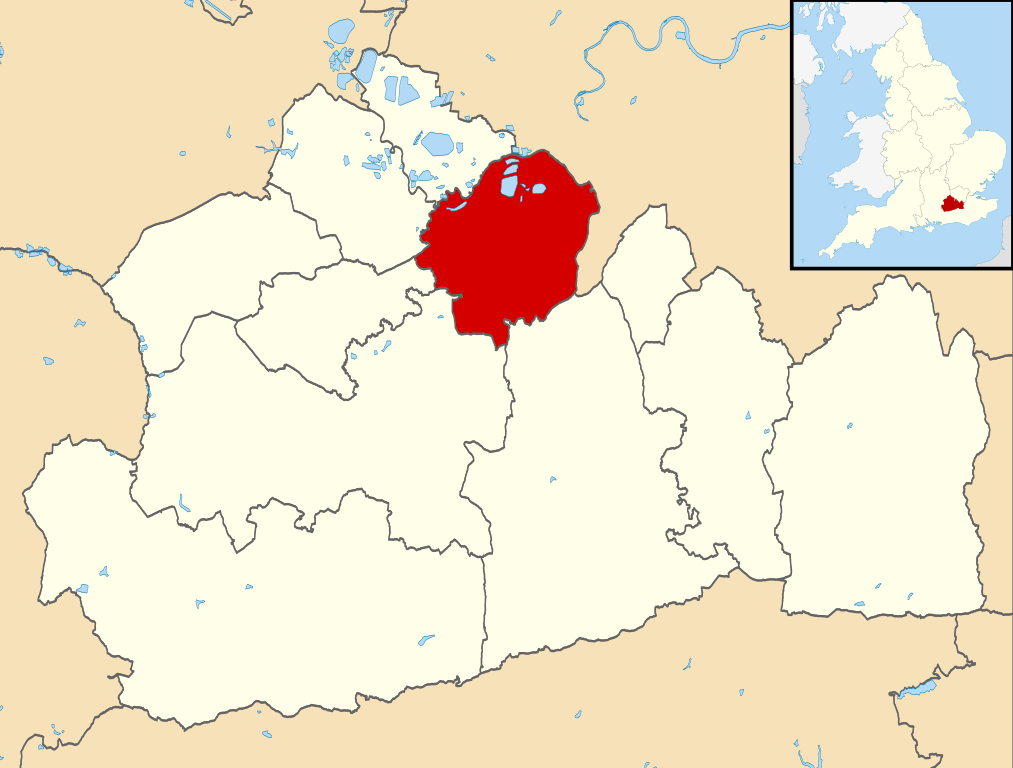
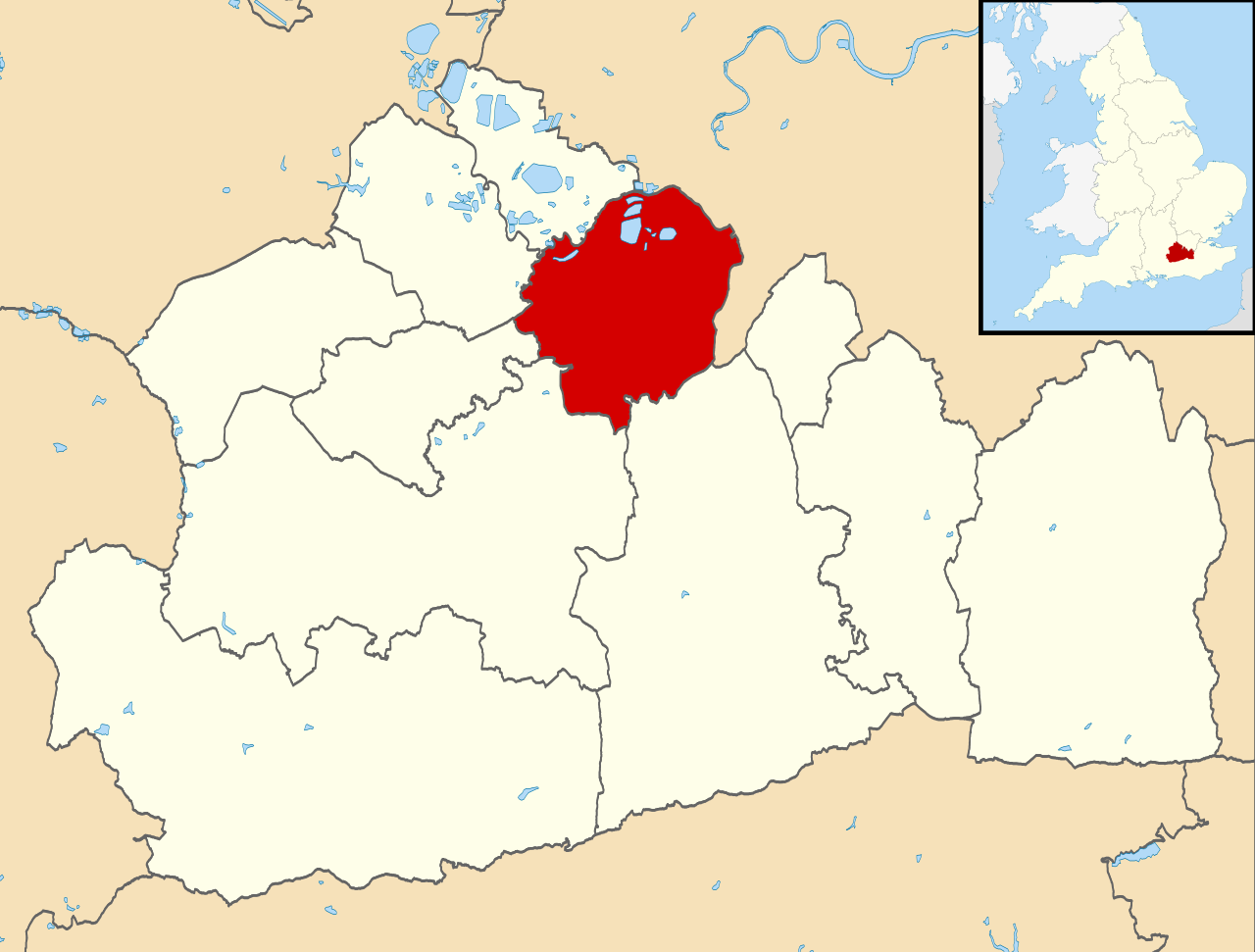
| Description | Equirectangular map projection on WGS 84 datum, with N/S stretched 160% |
| Date | |
| Source |
|
| Author | Nilfanion, created using Ordnance Survey data |
| Permission (Reusing this file) | This file is licensed under the Creative Commons Attribution-Share Alike 3.0 Unported license. Attribution: Contains Ordnance Survey data © Crown copyright and database right
|
File history
Click on a date/time to view the file as it appeared at that time.
| Date/Time | Thumbnail | Dimensions | User | Comment | |
|---|---|---|---|---|---|
| current | 09:24, 2 August 2011 | | 1,425 × 1,081 (948 KB) | Nilfanion | {{Information |Description=Map of Surrey, UK with Elmbridge highlighted. Equirectangular map projection on WGS 84 datum, with N/S stretched 160% |Source=Ordnance Survey [https://www.ordnancesurvey.co.uk/ |
File usage
There are no pages that use this file.
Global file usage
The following other wikis use this file:
- Usage on cy.wikipedia.org
- Usage on en.wikipedia.org
- Brooklands
- Cobham, Surrey
- Weybridge
- Weybridge Heath
- Esher
- Borough of Elmbridge
- Long Ditton
- Walton-on-Thames
- Claremont (country house)
- Thames Ditton
- Hersham
- Oxshott
- Oxshott Heath and Woods
- Stoke d'Abernon
- Thames Ditton railway station
- Hampton Court railway station
- Weybridge railway station
- Esher railway station
- Hersham railway station
- Walton-on-Thames railway station
- Moulsey Hurst
- Claygate
- Molesey
- St George's College, Weybridge
- Sandown Park Racecourse
- Hinchley Wood railway station
- Reed's School
- Esher Sixth Form College
- Walton & Hersham F.C.
- Metropolitan Police F.C.
- Molesey F.C.
- Walton Casuals F.C.
- Addlestone & Weybridge Town F.C.
- Thames Ditton Lawn Tennis Club
- Painshill
- Heathside School
- Hurst Park Racecourse
- Whiteley Village
- Claygate railway station
- Oxshott railway station
- Cobham & Stoke d'Abernon railway station
- Church of St Nicholas, Thames Ditton
- Giggs Hill Green
- Weston Green
- Hinchley Wood
- Downside, Surrey
- Molesey Lock
- Molesey Boat Club
- East Molesey Cricket Club
View more global usage of this file.
Explore the world

United states
New York

Japan
Tokyo

Singapore
Singapore
