
 Français
 Italiano
Size of this PNG preview of this SVG file: 529 × 600 pixels. Other resolutions: 212 × 240 pixels | 423 × 480 pixels | 677 × 768 pixels | 903 × 1,024 pixels | 1,806 × 2,048 pixels | 850 × 964 pixels.
Original file (SVG file, nominally 850 × 964 pixels, file size: 45 KB)
This is a file from the Wikimedia Commons and may be used by other projects. Information from its description page there is shown below. Commons is a freely licensed media file repository. |
Summary
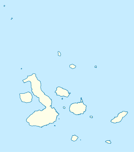
| Description | Quadratische Plattkarte. Geographische Begrenzung der Karte:
Equirectangular projection. Geographic limits of the map:
|
| Date | 2 March 2009 (upload date) |
| Source | own work, using
|
| Author | NordNordWest |
| Other versions | Derivative works of this file: Galapagos Simple Map.png |
 | This map has been made or improved in the German Kartenwerkstatt (Map Lab). You can propose maps to improve as well. |
Licensing
I, the copyright holder of this work, hereby publish it under the following licenses:
 | Permission is granted to copy, distribute and/or modify this document under the terms of the GNU Free Documentation License, Version 1.2 or any later version published by the Free Software Foundation; with no Invariant Sections, no Front-Cover Texts, and no Back-Cover Texts. A copy of the license is included in the section entitled GNU Free Documentation License. |
This file is licensed under the Creative Commons Attribution 3.0 Unported license.
- You are free:
- to share – to copy, distribute and transmit the work
- to remix – to adapt the work
- Under the following conditions:
- attribution – You must give appropriate credit, provide a link to the license, and indicate if changes were made. You may do so in any reasonable manner, but not in any way that suggests the licensor endorses you or your use.
You may select the license of your choice.
File history
Click on a date/time to view the file as it appeared at that time.
| Date/Time | Thumbnail | Dimensions | User | Comment | |
|---|---|---|---|---|---|
| current | 14:32, 2 March 2009 | | 850 × 964 (45 KB) | NordNordWest | {{Information |Description= {{de|Positionskarte der Galápagos-Inseln, Ecuador}} Quadratische Plattkarte. Geographische Begrenzung der Karte: * N: 1.8° N * S: 1.6° S * W: 92.1° W * O: 89.1° W {{en|Location map |
File usage
There are no pages that use this file.
Global file usage
The following other wikis use this file:
- Usage on ar.wikipedia.org
- Usage on ast.wikipedia.org
- Puntu caliente de Galápagos
- Islla Isabela
- Islla Floreana
- Reserva marina de Galápagos
- Aeropuertu Seymour
- Aeropuertu de San Cristóbal
- Módulu:Mapa de llocalización/datos/Islles Galápagos
- Módulu:Mapa de llocalización/datos/Islles Galápagos/usu
- Islla Gardner de Floreana
- Islla Caldwell
- Islla Genovesa
- Islla Pinta
- Islla Enderby (Galápagos)
- Usage on be.wikipedia.org
- Usage on bg.wikipedia.org
- Usage on bs.wikipedia.org
- Usage on ceb.wikipedia.org
- Usage on ckb.wikipedia.org
- Usage on cs.wikipedia.org
- Šablona:LocMap Galapágy
- Wikipedie:WikiProjekt Česko-slovenská Wikipedie/Přeložené články/2014-02/Galerie
- Alcedo (sopka)
- Cerro Azul (Galapágy)
- Darwin (sopka)
- Ecuador (sopka)
- Fernandina
- Genovesa
- Marchena (ostrov)
- Pinta (ostrov)
- San Cristóbal (ostrov)
- Santiago (Galapágy)
- Sierra Negra (sopka)
- Wolf (sopka)
- Puerto Baquerizo Moreno
- Isabela (Galapágy)
- La Cumbre
- Usage on da.wikipedia.org
- Usage on de.wikipedia.org
- Usage on en.wikipedia.org
View more global usage of this file.
Explore the world

United states
New York

Japan
Tokyo

Singapore
Singapore
