
 Français
 Italiano
Size of this PNG preview of this SVG file: 599 × 600 pixels. Other resolutions: 240 × 240 pixels | 480 × 480 pixels | 767 × 768 pixels | 1,023 × 1,024 pixels | 2,046 × 2,048 pixels | 1,040 × 1,041 pixels.
Original file (SVG file, nominally 1,040 × 1,041 pixels, file size: 134 KB)
This is a file from the Wikimedia Commons and may be used by other projects. Information from its description page there is shown below. Commons is a freely licensed media file repository. |
Summary
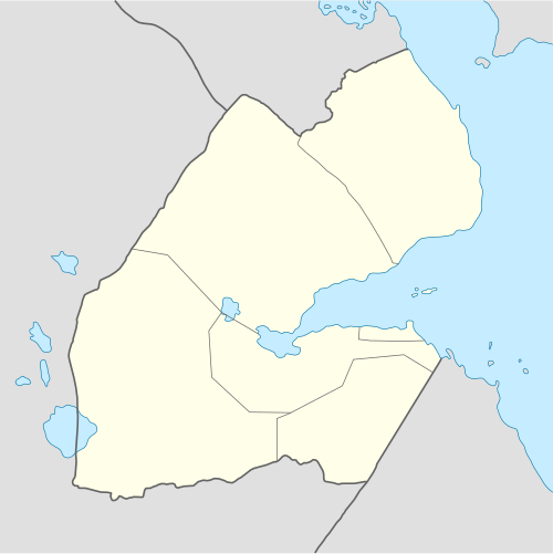
| Description | Deutsch: Positionskarte von Dschibuti Quadratische Plattkarte. Geographische Begrenzung der Karte:
English: Location map of Djibouti Equirectangular projection. Geographic limits of the map:
|
| Date | |
| Source | own work, using
|
| Author | NordNordWest |
| Other versions |
|

 | This map has been made or improved in the German Kartenwerkstatt (Map Lab). You can propose maps to improve as well. |
Licensing
I, the copyright holder of this work, hereby publish it under the following licenses:
 | Permission is granted to copy, distribute and/or modify this document under the terms of the GNU Free Documentation License, Version 1.2 or any later version published by the Free Software Foundation; with no Invariant Sections, no Front-Cover Texts, and no Back-Cover Texts. A copy of the license is included in the section entitled GNU Free Documentation License. |
This file is licensed under the Creative Commons Attribution-Share Alike 3.0 Unported license.
- You are free:
- to share – to copy, distribute and transmit the work
- to remix – to adapt the work
- Under the following conditions:
- attribution – You must give appropriate credit, provide a link to the license, and indicate if changes were made. You may do so in any reasonable manner, but not in any way that suggests the licensor endorses you or your use.
- share alike – If you remix, transform, or build upon the material, you must distribute your contributions under the same or compatible license as the original.
You may select the license of your choice.
File history
Click on a date/time to view the file as it appeared at that time.
| Date/Time | Thumbnail | Dimensions | User | Comment | |
|---|---|---|---|---|---|
| current | 21:04, 25 September 2008 | | 1,040 × 1,041 (134 KB) | NordNordWest | {{Information |Description= {{de|Positionskarte von Dschibuti}} Quadratische Plattkarte. Geographische Begrenzung der Karte: * N: 12.9° N * S: 10.7° N * W: 41.5° O * O: 43.7° O {{en|Location map of Djibouti}} Equirec |
File usage
There are no pages that use this file.
Global file usage
The following other wikis use this file:
- Usage on af.wikipedia.org
- Usage on am.wikipedia.org
- Usage on ar.wikipedia.org
- Usage on ast.wikipedia.org
- Usage on azb.wikipedia.org
- تاجوره
- ارتا، جیبوتی
- اوبوک
- علی صبیح
- راندا، جیبوتی
- هلهول
- جلیل، جیبوتی
- اسامو
- آسا قایلا
- مولود، جیبوتی
- داسبیو
- علی ادی
- وع
- جویستی
- انابا
- بویا، جیبوتی
- علایلی دادا
- جوبیتو
- دره، جیبوتی
- آس ایلا
- یوبوکی
- کوسور
- دامرجوق
- غالافی
- ایرولاف
- شابلی، جیبوتی
- ادایلو
- خور آنقار
- لویادا
- سانکال
- کوتا بویا
- مادقول، جیبوتی
- مالاهو
- قورابوس
- اندالی، دیجیبوتی
- داقویرو
- امبابو
- Usage on az.wikipedia.org
View more global usage of this file.
Explore the world

United states
New York

Japan
Tokyo

Singapore
Singapore
