
 Français
 Italiano
Size of this PNG preview of this SVG file: 783 × 600 pixels. Other resolutions: 313 × 240 pixels | 627 × 480 pixels | 1,003 × 768 pixels | 1,280 × 980 pixels | 2,560 × 1,961 pixels | 1,000 × 766 pixels.
Original file (SVG file, nominally 1,000 × 766 pixels, file size: 252 KB)
This is a file from the Wikimedia Commons and may be used by other projects. Information from its description page there is shown below. Commons is a freely licensed media file repository. |
.svg)
Summary
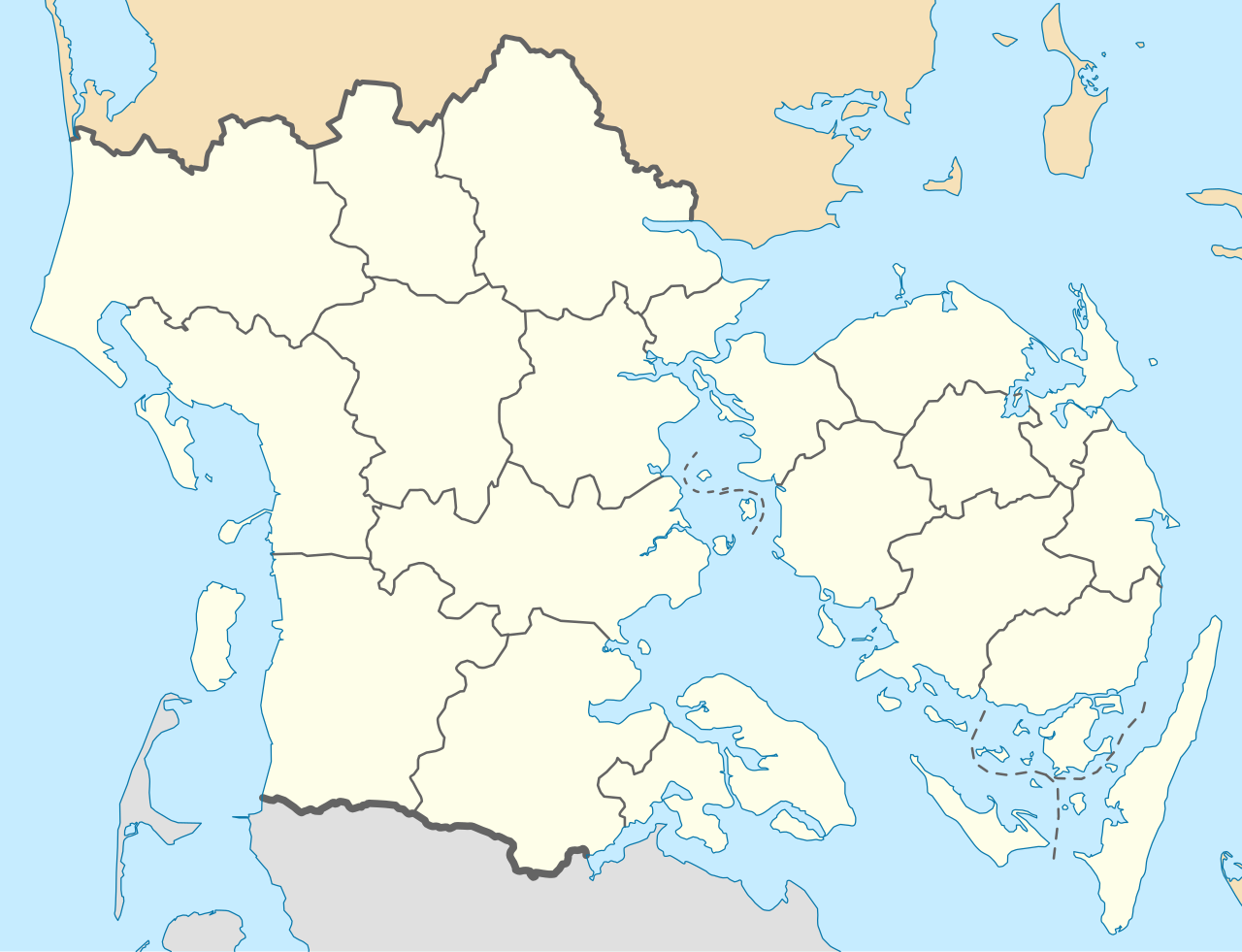
| Description | English: Location map of Region South Denmark in Denmark, color adjusted Equirectangular projection, N/S stretching 177 %. Geographic limits of the map:
Deutsch: Positionskarte von der Region Syddanmark in Dänemark, Farben wurden angepasst Quadratische Plattkarte, N-S-Streckung 177 %. Geographische Begrenzung der Karte:
Dansk: Positionskort over Region Syddanmark, farverne er justeret. Kvadratisk udsnit, N-S-strækning 177 %. Geografiske begrænsninger på kortet:
|
| Date | |
| Source | Own work, derived from Denmark_South_Denmark_location_map.svg |
| Author | Erik Frohne |
| Other versions | Denmark South Denmark location map.svg |
| SVG development |
Licensing
I, the copyright holder of this work, hereby publish it under the following licenses:
 | Permission is granted to copy, distribute and/or modify this document under the terms of the GNU Free Documentation License, Version 1.2 or any later version published by the Free Software Foundation; with no Invariant Sections, no Front-Cover Texts, and no Back-Cover Texts. A copy of the license is included in the section entitled GNU Free Documentation License. |
This file is licensed under the Creative Commons Attribution-Share Alike 3.0 Unported license.
- You are free:
- to share – to copy, distribute and transmit the work
- to remix – to adapt the work
- Under the following conditions:
- attribution – You must give appropriate credit, provide a link to the license, and indicate if changes were made. You may do so in any reasonable manner, but not in any way that suggests the licensor endorses you or your use.
- share alike – If you remix, transform, or build upon the material, you must distribute your contributions under the same or compatible license as the original.
You may select the license of your choice.
File history
Click on a date/time to view the file as it appeared at that time.
| Date/Time | Thumbnail | Dimensions | User | Comment | |
|---|---|---|---|---|---|
| current | 13:26, 13 January 2010 | | 1,000 × 766 (252 KB) | Erik Frohne | == {{int:filedesc}} == {{Information |Description={{en|1=Location map of Region South Denmark in Denmark, color adjusted Equirectangular projection, N/S stretching 177 %. Geographic limits of the map: * N: 56.00° N * S: 54.70° N * W: 8.00° E * E: 11 |
File usage
There are no pages that use this file.
Global file usage
The following other wikis use this file:
- Usage on da.wikipedia.org
- Esbjerg
- Odense
- Ribe
- Illum (ø)
- Aabenraa
- Dræet
- Æbeløholm
- Assens
- Christiansfeld
- Egeskov Slot
- Fredericia
- Frøslevlejren
- Haderslev Domkirke
- Hagenskov
- Helnæs Fyr
- Marstal
- Middelfart
- Fanø
- Thurø
- Ribe Domkirke
- Sankt Nicolai Kirke (Aabenraa)
- Styrtom
- Tønder
- Billund
- Vorbasse
- Ravningbroen
- Vojens
- Nyborg
- Svendborg
- Svendborgsund
- Rudkøbing
- Seden
- Sønderborg Slot
- Kolding
- Vejle
- Sankt Knuds Kirke (Odense)
- Ærøskøbing
- Strynø
- Ho (by)
- Nyborg Gymnasium
- Kerteminde
- Billund Lufthavn
- Sønderborg
- Tinglev
- Padborg
- Mølholm (Vejle)
- Odense Zoo
- Tarp (Esbjerg Kommune)
- Tandslet
- Birkholm
View more global usage of this file.
.svg)
.svg)
Explore the world

United states
New York

Japan
Tokyo

Singapore
Singapore
