
 Français
 Italiano
Size of this PNG preview of this SVG file: 524 × 600 pixels. Other resolutions: 210 × 240 pixels | 419 × 480 pixels | 671 × 768 pixels | 895 × 1,024 pixels | 1,789 × 2,048 pixels | 1,106 × 1,266 pixels.
Original file (SVG file, nominally 1,106 × 1,266 pixels, file size: 995 KB)
This is a file from the Wikimedia Commons and may be used by other projects. Information from its description page there is shown below. Commons is a freely licensed media file repository. |
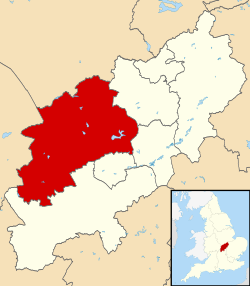
| Description | Map of Northamptonshire, UK with Daventry highlighted. Equirectangular map projection on WGS 84 datum, with N/S stretched 160% |
| Date | |
| Source |
|
| Author | Nilfanion, created using Ordnance Survey data |
| Permission (Reusing this file) | This file is licensed under the Creative Commons Attribution-Share Alike 3.0 Unported license. Attribution: Contains Ordnance Survey data © Crown copyright and database right
|
File history
Click on a date/time to view the file as it appeared at that time.
| Date/Time | Thumbnail | Dimensions | User | Comment | |
|---|---|---|---|---|---|
| current | 22:13, 13 August 2011 | | 1,106 × 1,266 (995 KB) | Nilfanion | {{Information |Description=Map of Northamptonshire, UK with Daventry highlighted. Equirectangular map projection on WGS 84 datum, with N/S stretched 160% |Source=Ordnance Survey [http |
File usage
There are no pages that use this file.
Global file usage
The following other wikis use this file:
- Usage on bg.wikipedia.org
- Usage on cy.wikipedia.org
- Usage on en.wikipedia.org
- Long Buckby
- Braunston
- Naseby
- Daventry
- Althorp
- Daventry District
- East Farndon
- Welford, Northamptonshire
- Crick, Northamptonshire
- Arthingworth
- Ashby St Ledgers
- Badby
- Barby, Northamptonshire
- Boughton, Northamptonshire
- Woodford Halse
- Brixworth
- Brockhall, Northamptonshire
- Byfield, Northamptonshire
- Canons Ashby
- Watford, Northamptonshire
- Yelvertoft
- Winwick, Northamptonshire
- Whilton
- West Haddon
- Walgrave
- Upper Catesby
- Thornby, Northamptonshire
- Teeton
- Sulby, Northamptonshire
- Church Stowe
- Staverton, Northamptonshire
- Spratton
- Sibbertoft
- Scaldwell
- Ravensthorpe, Northamptonshire
- Preston Capes
- Pitsford
- Overstone, Northamptonshire
- Old, Northamptonshire
- Norton, Northamptonshire
- Newnham, Northamptonshire
- Moulton, Northamptonshire
- Marston Trussell
- Maidwell
- Kilsby
- Lamport, Northamptonshire
- Lilbourne
- Little Brington
View more global usage of this file.
Explore the world

United states
New York

Japan
Tokyo

Singapore
Singapore
