
 Français
 Italiano
Size of this PNG preview of this SVG file: 800 × 536 pixels. Other resolutions: 320 × 215 pixels | 640 × 429 pixels | 1,024 × 687 pixels | 1,280 × 858 pixels | 2,560 × 1,716 pixels | 974 × 653 pixels.
Original file (SVG file, nominally 974 × 653 pixels, file size: 218 KB)
This is a file from the Wikimedia Commons and may be used by other projects. Information from its description page there is shown below. Commons is a freely licensed media file repository. |
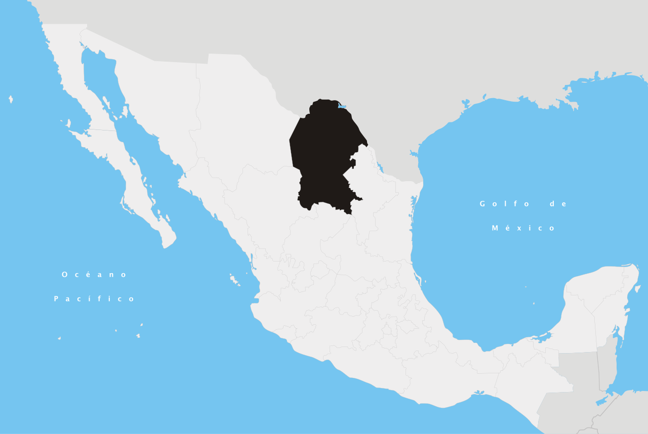
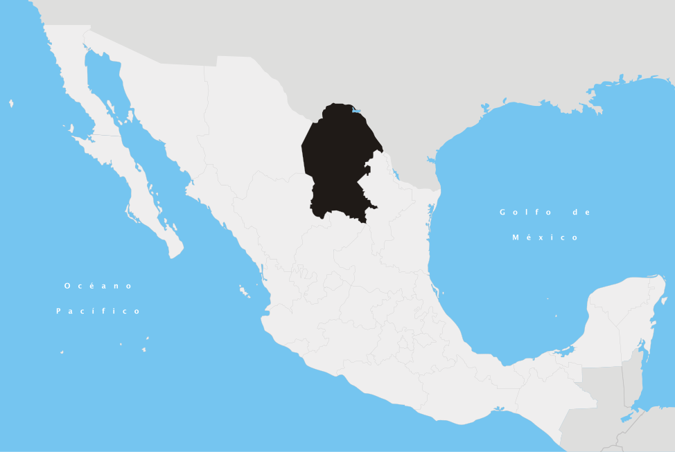
| Description | Español: Ubicación del estado de Coahuila de Zaragoza en la República Mexicana | ||
| Date | |||
| Source | Own work | ||
| Author | Yavidaxiu | ||
| Permission (Reusing this file) |
|
File history
Click on a date/time to view the file as it appeared at that time.
| Date/Time | Thumbnail | Dimensions | User | Comment | |
|---|---|---|---|---|---|
| current | 01:14, 21 April 2007 | | 974 × 653 (218 KB) | Yavidaxiu | {{Information |Description={{es|Ubicación del estado de Coahuila de Zaragoza en la República Mexicana}} |Source= Trabajo propio |Date= 20 de abril de 2007 |Author= Yavidaxiu |Permission= {{PD-self}} |other_versions= }} Category:Maps of Coahuila [[C |
File usage
There are no pages that use this file.
Global file usage
The following other wikis use this file:
- Usage on af.wikipedia.org
- Usage on an.wikipedia.org
- Usage on en.wikipedia.org
- Coahuila
- Piedras Negras, Coahuila
- Torreón
- Cuatro Ciénegas
- Monclova
- Abasolo, Coahuila
- Ciudad Frontera
- Candela, Coahuila
- Castaños
- Escobedo, Coahuila
- Lamadrid
- Nadadores
- Sacramento, Coahuila
- San Buenaventura, Coahuila
- Coahuila y Tejas
- Laguna del Rey
- Jiménez, Coahuila
- Parras
- Nueva Rosita
- Ramos Arizpe
- Allende, Coahuila
- Arteaga, Coahuila
- Palaú
- Francisco I. Madero, Coahuila
- Saltillo Municipality
- Sabinas, Coahuila
- Matamoros, Coahuila
- San Pedro, Coahuila
- Viesca
- Hidalgo, Coahuila
- Frontera Municipality
- Monterreal
- Template:Coahuila-geo-stub
- Saltillo
- Wikipedia:WikiProject Mexico/State templates
- Template:Coahuila
- Abasolo Municipality, Coahuila
- Acuña Municipality
- Allende Municipality, Coahuila
- Candela Municipality
- Castaños Municipality
- Cuatrociénegas Municipality
- Escobedo Municipality
- Francisco I. Madero Municipality, Coahuila
- General Cepeda Municipality
- Guerrero Municipality, Coahuila
- Arteaga Municipality, Coahuila
View more global usage of this file.
Explore the world

United states
New York

Japan
Tokyo

Singapore
Singapore
