
 Français
 Italiano
Size of this PNG preview of this SVG file: 730 × 600 pixels. Other resolutions: 292 × 240 pixels | 584 × 480 pixels | 935 × 768 pixels | 1,246 × 1,024 pixels | 2,492 × 2,048 pixels | 948 × 779 pixels.
Original file (SVG file, nominally 948 × 779 pixels, file size: 94 KB)
This is a file from the Wikimedia Commons and may be used by other projects. Information from its description page there is shown below. Commons is a freely licensed media file repository. |
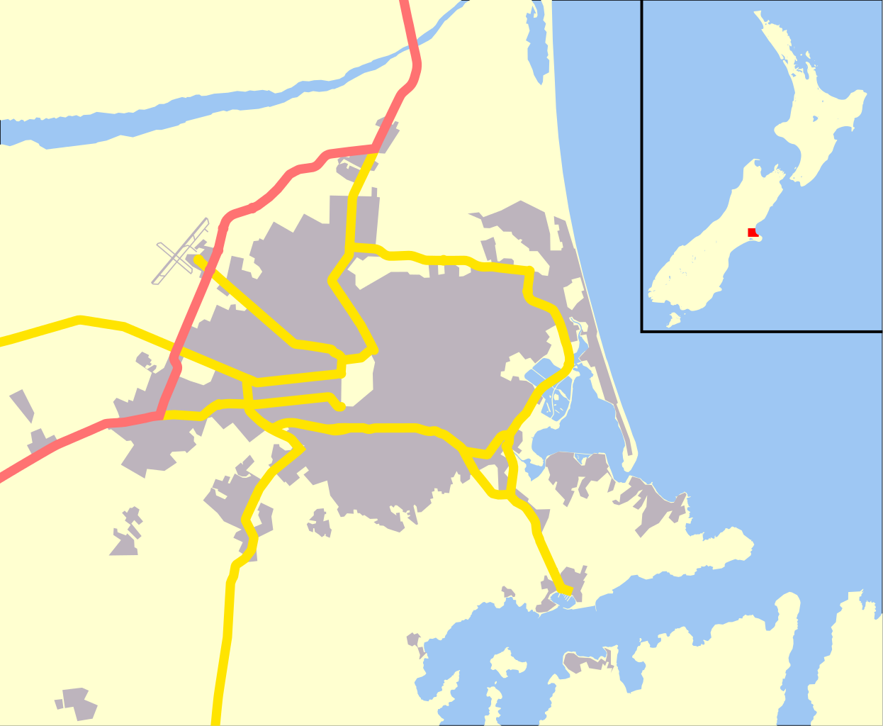
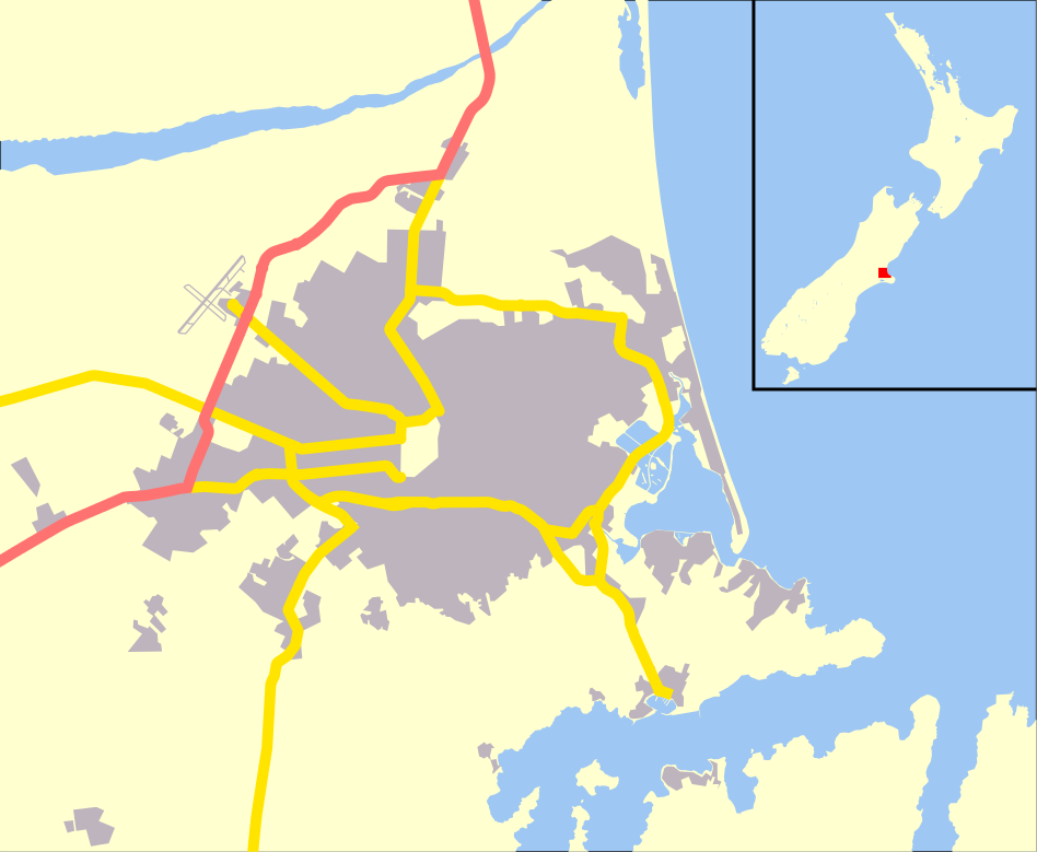
| Description | English: Map of Christchurch, New Zealand, derivative of OpenStreetMap. |
| Date | |
| Source | Own work |
| Author | Benchill |
| Permission (Reusing this file) | This file is licensed under the Creative Commons Attribution-Share Alike 2.0 Generic license.
|
| Other versions | Derivative works of this file: Aidanfield map.jpg |
| SVG development |
File history
Click on a date/time to view the file as it appeared at that time.
| Date/Time | Thumbnail | Dimensions | User | Comment | |
|---|---|---|---|---|---|
| current | 01:13, 4 May 2010 | | 948 × 779 (94 KB) | Benchill | {{Information |Description={{en|1=Map of Christchurch, New Zealand, derivative of OpenStreetMap.}} |Source={{own}} |Author=Benchill |Date=2010-05-04 |Permission={{cc-by-sa-2.0}} |other_versions= }} {{Created with Inkscape}} [[Category:Ma |
File usage
There are no pages that use this file.
Global file usage
The following other wikis use this file:
- Usage on ar.wikipedia.org
- Usage on bn.wikipedia.org
- Usage on br.wikipedia.org
- Usage on ceb.wikipedia.org
- Usage on da.wikipedia.org
- Usage on en.wikipedia.org
- Christchurch Airport
- Air Force Museum of New Zealand
- Cashmere High School
- Wigram Aerodrome
- Murray Aynsley Hill
- Cathedral of the Blessed Sacrament, Christchurch
- Sugarloaf (New Zealand)
- Module:Location map/data/New Zealand Christchurch/doc
- Christchurch Hospital
- 2011 Christchurch earthquake
- Cass Peak
- User:DeniseFord/sandbox
- Module:Location map/data/New Zealand Christchurch
- 1990 Eisenhower Trophy
- Christchurch mosque shootings
- Al Noor Mosque, Christchurch
- Linwood Islamic Centre
- Beth El Synagogue, Christchurch
- Kennedy's Bush Scenic Reserve
- Wikipedia:WikiProject New Zealand/Christchurch Taskforce
- Template:Infobox marae/testcases
- Christchurch Seagull Pit
- Usage on eo.wikipedia.org
- Usage on fa.wikipedia.org
- Usage on fr.wikipedia.org
- Usage on id.wikipedia.org
- Usage on ja.wikipedia.org
- Usage on kn.wikipedia.org
View more global usage of this file.
Explore the world

United states
New York

Japan
Tokyo

Singapore
Singapore
