
 Français
 Italiano
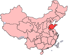
No higher resolution available.
China-Shandong.png (268 × 218 pixels, file size: 31 KB, MIME type: image/png)
This is a file from the Wikimedia Commons and may be used by other projects. Information from its description page there is shown below. Commons is a freely licensed media file repository. |
 | File:Shandong in China (+all claims hatched).svg is a vector version of this file. It should be used in place of this PNG file when not inferior. File:China-Shandong.png → File:Shandong in China (+all claims hatched).svg For more information, see Help:SVG. | .svg) |
Summary
| Description | English: Location of Shandong Province in the People's Republic of China. See Locator maps of province-level divisions of the People's Republic of China for more information. 中文:山東省在中華人民共和國的位置。另見Locator maps of province-level divisions of the People's Republic of China。 |
| Source | |
| Author |
 | Permission is granted to copy, distribute and/or modify this document under the terms of the GNU Free Documentation License, Version 1.2 or any later version published by the Free Software Foundation; with no Invariant Sections, no Front-Cover Texts, and no Back-Cover Texts. A copy of the license is included in the section entitled GNU Free Documentation License. |
| This file is licensed under the Creative Commons Attribution-Share Alike 3.0 Unported license. | ||
| ||
| This licensing tag was added to this file as part of the GFDL licensing update. |
File history
Click on a date/time to view the file as it appeared at that time.
| Date/Time | Thumbnail | Dimensions | User | Comment | |
|---|---|---|---|---|---|
| current | 18:08, 28 October 2007 | | 268 × 218 (31 KB) | Croquant | transparent background |
| 21:52, 4 June 2005 |  | 268 × 218 (9 KB) | Ran | ||
| 15:09, 9 May 2005 |  | 268 × 218 (8 KB) | Airunp | Made by uploader. See also: <br>Wikipedia:WikiProject Chinese provinces/Locator maps {{GFDL}} Ran from en: wikipedia Category:Maps of China |
File usage
There are no pages that use this file.
Global file usage
The following other wikis use this file:
- Usage on ar.wikipedia.org
- Usage on bs.wikinews.org
- Usage on da.wikipedia.org
- Usage on de.wikipedia.org
- Usage on de.wikinews.org
- Usage on en.wikipedia.org
- Jieshi, Shandong
- Liangshan County
- Wikipedia:WikiProject Chinese provinces/Locator maps
- Laizhou Bay
- Nanchenjiazhuang
- Muping, Yantai
- Xintai
- Laiyang
- Linzi, Zibo
- Zhoucun, Zibo
- Zhangqiu, Jinan
- Xiajin County
- Teng (state)
- Shanwang National Geological Park
- Rongcheng, Shandong
- Wendeng, Weihai
- Rushan, Shandong
- Mount Ta
- Juye County
- Dige
- Laoling
- Laizhou
- Gaomi
- Lu Xun Park (Qingdao)
- Linyi Qiyang International Airport
- Weifang Airport
- Template:Shandong-geo-stub
- Ningyang County
- Yantai Economic and Technological Development Zone
- Port of Yantai
- Port of Weihai
- Pingyin County
- Changle County
- Ju County
- Wulian County
- Pingyi County
- Boxing County
- Yutai County
- Lingcheng, Dezhou
- Baimai Springs
- Black Tiger Spring
- Pearl Spring
- Jiaonan
- Laixi
View more global usage of this file.
Explore the world

United states
New York

Japan
Tokyo

Singapore
Singapore
