
 Français
 Italiano
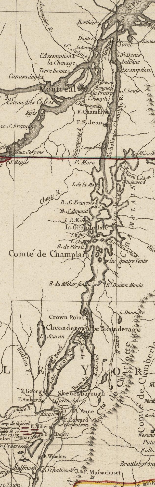
Size of this preview: 191 × 598 pixels. Other resolutions: 76 × 240 pixels | 632 × 1,980 pixels.
Original file (632 × 1,980 pixels, file size: 641 KB, MIME type: image/jpeg)
This is a file from the Wikimedia Commons and may be used by other projects. Information from its description page there is shown below. Commons is a freely licensed media file repository. |
Summary
| Description | English: This is a detail from the source map, depicting only the Upper Hudson River Valley and the Champlain Valley as far as Montreal. | |||||||||||||||||||
| Date | ||||||||||||||||||||
| Source | Norman B. Leventhal Map Center at the Boston Public Library Call Number: G3711.S3 1777 .B75 URL at time of upload: http://maps.bpl.org/details_10101/ | |||||||||||||||||||
| Author |
| |||||||||||||||||||
Licensing
This media file is in the public domain in the United States. This applies to U.S. works where the copyright has expired, often because its first publication occurred prior to January 1, 1930, and if not then due to lack of notice or renewal. See this page for further explanation. |  | |
 |
| This work is in the public domain in its country of origin and other countries and areas where the copyright term is the author's life plus 100 years or fewer. | |
| This file has been identified as being free of known restrictions under copyright law, including all related and neighboring rights. | |
File history
Click on a date/time to view the file as it appeared at that time.
| Date/Time | Thumbnail | Dimensions | User | Comment | |
|---|---|---|---|---|---|
| current | 16:27, 18 April 2009 | 632 × 1,980 (641 KB) | Magicpiano | Higher-resolution version. | |
| 21:33, 9 January 2009 | 244 × 762 (92 KB) | Magicpiano | {{Information |Description={{en|1=This is a detail from the source map, depicting only the Upper Hudson River Valley and the Champlain Valley as far as Montreal. }} |Source=Norman B. Leventhal Map Center at the Boston Public Library Call Number: G3711.S3 |
File usage
There are no pages that use this file.
Global file usage
The following other wikis use this file:
- Usage on cs.wikipedia.org
- Usage on en.wikipedia.org
- Usage on es.wikipedia.org
- Usage on fr.wikipedia.org
- Usage on it.wikipedia.org
- Usage on pl.wikipedia.org
Metadata
Explore the world

United states
New York

Japan
Tokyo

Singapore
Singapore
