
 Français
 Italiano
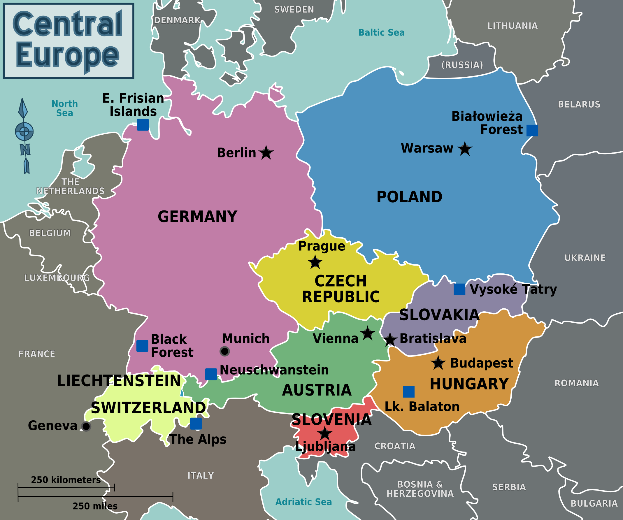
Size of this preview: 718 × 599 pixels. Other resolutions: 288 × 240 pixels | 575 × 480 pixels | 920 × 768 pixels | 1,227 × 1,024 pixels | 2,137 × 1,784 pixels.
Original file (2,137 × 1,784 pixels, file size: 634 KB, MIME type: image/png)
This is a file from the Wikimedia Commons and may be used by other projects. Information from its description page there is shown below. Commons is a freely licensed media file repository. |
Summary
| Description | Countries of Central Europe, map for use on Wikivoyage, English version |
| Date | |
| Source | Own work based on the regional map of Europe by Stefan Ertmann |
| Author | LtPowers |
| Other versions | []
Notes:
|
.png)


.png)
.png)
.svg)
.png)
Licensing
This file is licensed under the Creative Commons Attribution-Share Alike 4.0 International, 3.0 Unported, 2.5 Generic, 2.0 Generic and 1.0 Generic license.
- You are free:
- to share – to copy, distribute and transmit the work
- to remix – to adapt the work
- Under the following conditions:
- attribution – You must give appropriate credit, provide a link to the license, and indicate if changes were made. You may do so in any reasonable manner, but not in any way that suggests the licensor endorses you or your use.
- share alike – If you remix, transform, or build upon the material, you must distribute your contributions under the same or compatible license as the original.
Original upload log
| This file was imported from Wikivoyage WTS. |
The original description page was here. All following user names refer to wts.wikivoyage-old.
- 2009-02-08 21:10 (WT-shared) LtPowers[dead link] 2147×1793 (623678 bytes) == Summary == {{Imagecredit|credit=[[User:LtPowers]]|captureDate=8 February 2009|location=Europe|source=[[:Image:Europe regions.svg]] (cc-by (Import from wikitravel.org/shared)
File history
Click on a date/time to view the file as it appeared at that time.
| Date/Time | Thumbnail | Dimensions | User | Comment | |
|---|---|---|---|---|---|
| current | 15:16, 1 May 2013 | | 2,137 × 1,784 (634 KB) | LtPowers | Updated cities and other destinations to match article |
| 23:07, 17 November 2012 |  | 2,147 × 1,793 (609 KB) | MGA73bot2 | {{BotMoveToCommons|wts.oldwikivoyage|year={{subst:CURRENTYEAR}}|month={{subst:CURRENTMONTHNAME}}|day={{subst:CURRENTDAY}}}} == {{int:filedesc}} == {{Information |description=Countries of Central Europe. Map showing the nations and borders of Central Eu... |
File usage
The following 2 pages use this file:
Global file usage
The following other wikis use this file:
- Usage on bn.wikivoyage.org
- Usage on el.wikivoyage.org
- Usage on fa.wikipedia.org
- Usage on fa.wikivoyage.org
- Usage on fi.wikivoyage.org
- Usage on he.wikivoyage.org
- Usage on id.wikivoyage.org
- Usage on incubator.wikimedia.org
- Usage on ja.wikivoyage.org
- Usage on nl.wikivoyage.org
- Usage on uk.wikivoyage.org
- Usage on vi.wikivoyage.org
Metadata
Explore the world

United states
New York

Japan
Tokyo

Singapore
Singapore
