
 Français
 Italiano
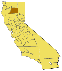
No higher resolution available.
California_map_showing_Shasta_County.png (200 × 231 pixels, file size: 22 KB, MIME type: image/png)
This is a file from the Wikimedia Commons and may be used by other projects. Information from its description page there is shown below. Commons is a freely licensed media file repository. |
Map of Shasta county in California. From en:
 | Permission is granted to copy, distribute and/or modify this document under the terms of the GNU Free Documentation License, Version 1.2 or any later version published by the Free Software Foundation; with no Invariant Sections, no Front-Cover Texts, and no Back-Cover Texts. A copy of the license is included in the section entitled GNU Free Documentation License. |
| This file is licensed under the Creative Commons Attribution-Share Alike 3.0 Unported license. | ||
| ||
| This licensing tag was added to this file as part of the GFDL licensing update. |
File history
Click on a date/time to view the file as it appeared at that time.
| Date/Time | Thumbnail | Dimensions | User | Comment | |
|---|---|---|---|---|---|
| current | 15:28, 14 July 2005 | | 200 × 231 (22 KB) | Pyramide~commonswiki | Map of Shasta county in California. From en: {{GFDL}} Category:Maps of counties in California |
File usage
There are no pages that use this file.
Global file usage
The following other wikis use this file:
- Usage on en.wikipedia.org
- Whiskeytown Falls
- Clear Creek (Sacramento River tributary)
- Lake Britton
- Hat Creek (California)
- Template:ShastaCountyCA-geo-stub
- Igo, California
- Whitmore, California
- Brushy Butte
- Oak Run, California
- Summit Lake (Reading Peak, Shasta County)
- Castella, California
- Big Bend Rancheria
- Bumpass Mountain
- Lake McCloud
- Baker Lake (California)
- Enterprise, Shasta County, California
- Happy Valley, Shasta County, California
- O'Brien, California
- Centerville, Shasta County, California
- Ono, California
- Rising River
- User:Magnolia677/Tunnel Inn, California
- Viola, California
- Dana, California
- Gas Point, California
- Ingot, California
- Johnson Park, California
- Jones Valley, California
- Shasta County Superior Court
- Soldier Mountain (California)
- User:Yurikcm/Brushy Butte
- Magee Peak
- Usage on es.wikipedia.org
- Usage on li.wikipedia.org
- Usage on pam.wikipedia.org
- Usage on www.wikidata.org
Explore the world

United states
New York

Japan
Tokyo

Singapore
Singapore
