
 Français
 Italiano
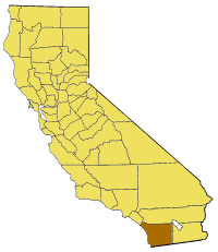
No higher resolution available.
California_map_showing_San_Diego_County.png (200 × 231 pixels, file size: 22 KB, MIME type: image/png)
This is a file from the Wikimedia Commons and may be used by other projects. Information from its description page there is shown below. Commons is a freely licensed media file repository. |
Map of San Diego county in California. From en:
 | Permission is granted to copy, distribute and/or modify this document under the terms of the GNU Free Documentation License, Version 1.2 or any later version published by the Free Software Foundation; with no Invariant Sections, no Front-Cover Texts, and no Back-Cover Texts. A copy of the license is included in the section entitled GNU Free Documentation License. |
| This file is licensed under the Creative Commons Attribution-Share Alike 3.0 Unported license. | ||
| ||
| This licensing tag was added to this file as part of the GFDL licensing update. |
File history
Click on a date/time to view the file as it appeared at that time.
| Date/Time | Thumbnail | Dimensions | User | Comment | |
|---|---|---|---|---|---|
| current | 15:25, 14 July 2005 | | 200 × 231 (22 KB) | Pyramide~commonswiki | Map of San Diego county in California. From en: {{GFDL}} Category:Maps of counties in California |
File usage
There are no pages that use this file.
Global file usage
The following other wikis use this file:
- Usage on ceb.wikipedia.org
- Usage on de.wikipedia.org
- Usage on en.wikipedia.org
- Mount Hope, San Diego
- Scripps Canyon
- Los Coches Creek
- Tecate, California
- Black Mountain (San Diego County, California)
- Jacumba Mountains
- Vallecito Mountains
- Santa Ysabel, California
- Balboa Park Gardens
- Tierra Blanca Mountains
- Palomar Mountain, California
- Terramar, Carlsbad, California
- Casa de Oro, California
- Pala, California
- San Dieguito County Park
- Talmadge, San Diego
- Template:SanDiegoCountyCA-geo-stub
- Proctor Valley
- San Carlos, San Diego
- Oceanside Pier
- Mile of Cars
- Marina, San Diego
- Core, San Diego
- Webster, San Diego
- Gateway, San Diego
- Rancho Guejito
- Middletown, San Diego
- Dehesa, California
- Hot Springs Mountain
- Batiquitos Lagoon
- Guatay, California
- Coyote Mountain (California)
- Soledad Valley
- Alvarado Estates, San Diego
- Mud Caves
- Rincon del Diablo, California
- Buena Vista Hills (San Diego County)
- Fletcher Hills
- Grapevine Hills
- Jamul Mountains
- North Pinyon Mountains
- Oat Hills (San Diego County)
- Pine Hills (California)
- Pinyon Mountains
- San Felipe Hills (San Diego County)
- San Marcos Mountains
- Santa Margarita Mountains
- Sawtooth Mountains (California)
View more global usage of this file.
Explore the world

United states
New York

Japan
Tokyo

Singapore
Singapore
