
 Français
 Italiano
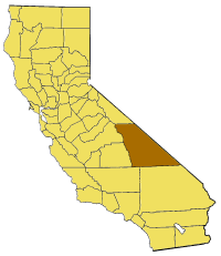
No higher resolution available.
California_map_showing_Inyo_County.png (200 × 231 pixels, file size: 22 KB, MIME type: image/png)
This is a file from the Wikimedia Commons and may be used by other projects. Information from its description page there is shown below. Commons is a freely licensed media file repository. |
Map of Inyo county in California. From en:
 | Permission is granted to copy, distribute and/or modify this document under the terms of the GNU Free Documentation License, Version 1.2 or any later version published by the Free Software Foundation; with no Invariant Sections, no Front-Cover Texts, and no Back-Cover Texts. A copy of the license is included in the section entitled GNU Free Documentation License. |
| This file is licensed under the Creative Commons Attribution-Share Alike 3.0 Unported license. | ||
| ||
| This licensing tag was added to this file as part of the GFDL licensing update. |
File history
Click on a date/time to view the file as it appeared at that time.
| Date/Time | Thumbnail | Dimensions | User | Comment | |
|---|---|---|---|---|---|
| current | 17:03, 1 July 2005 | | 200 × 231 (22 KB) | Pyramide~commonswiki | Map of Inyo county in California. From en: {{GFDL}} Category:Maps of counties in California |
File usage
There are no pages that use this file.
Global file usage
The following other wikis use this file:
- Usage on bg.wikipedia.org
- Usage on en.wikipedia.org
- Mount Baxter (California)
- Funeral Mountains
- Swansea, California
- Mount Humphreys
- Searles Valley
- Amargosa Range
- Loch Leven (California)
- Diaz Lake
- Cottonwood Mountains (Inyo County)
- Grapevine Mountains
- Black Mountains (California)
- Fish Slough Area of Critical Environmental Concern
- Greenwater Range
- Resting Spring Range
- Last Chance Range
- Sylvania Mountains
- Mount Sill
- Bishop Creek (Inyo County)
- Middle Palisade
- Morgan Creek (California)
- Palisade Glacier
- Template:InyoCountyCA-geo-stub
- Deep Springs, California
- Mount Barnard (California)
- Norman Clyde Glacier
- Middle Palisade Glacier
- Teakettle Junction, California
- Temple Crag
- Norman Clyde Peak
- Mount Le Conte (California)
- Independence dike swarm
- Mount Morgan (Inyo County, California)
- Birch Mountain
- Palisade Crest
- Calico Peaks
- Confidence Hills
- Darwin Hills
- Dublin Hills
- Ibex Hills
- Kit Fox Hills
- Poverty Hills
- Saline Range
- Santa Rosa Hills (Inyo County)
- Talc City Hills
- Tecopa Hills
- White Hills (Inyo County)
- Mount Abbot
- Smith Mountain (Death Valley)
- Fish Springs, California
View more global usage of this file.
Explore the world

United states
New York

Japan
Tokyo

Singapore
Singapore
