Size of this preview: 664 × 599 pixels. Other resolutions: 266 × 240 pixels | 532 × 480 pixels | 851 × 768 pixels | 1,135 × 1,024 pixels | 2,269 × 2,048 pixels | 3,200 × 2,888 pixels.
Original file (3,200 × 2,888 pixels, file size: 2.35 MB, MIME type: image/png)
File history
Click on a date/time to view the file as it appeared at that time.
| Date/Time | Thumbnail | Dimensions | User | Comment | |
|---|---|---|---|---|---|
| current | 17:42, 25 April 2010 |  | 3,200 × 2,888 (2.35 MB) | Mahahahaneapneap | Compressed |
| 12:56, 15 December 2009 |  | 3,200 × 2,888 (3.42 MB) | Cplakidas | larger & more detailed version, various corrections, Galata included | |
| 23:08, 30 June 2009 |  | 2,134 × 2,000 (1.62 MB) | Falcorian | Lossless compression with pngout. | |
| 22:47, 8 January 2009 |  | 2,134 × 2,000 (1.84 MB) | Cplakidas | more info, minor tweaks & corrections | |
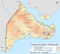
| 11:48, 28 October 2008 |  | 2,134 × 2,000 (1.76 MB) | Cplakidas | {{Information |Description={{en|1=Topographical map of Constantinople during the Byzantine period. Map source: R. Janin, ''Constantinople Byzantine. Developpement urbain et repertoire topographique''. Road network and some other d |
File usage
The following 2 pages use this file:
Global file usage
The following other wikis use this file:
- Usage on ace.wikipedia.org
- Usage on af.wikipedia.org
- Usage on ar.wikipedia.org
- Usage on arz.wikipedia.org
- Usage on ast.wikipedia.org
- Usage on azb.wikipedia.org
- Usage on az.wikipedia.org
- Usage on be.wikipedia.org
- Usage on bg.wikipedia.org
- Usage on bn.wikipedia.org
- Usage on br.wikipedia.org
- Usage on ca.wikipedia.org
- Usage on cdo.wikipedia.org
- Usage on ceb.wikipedia.org
- Usage on cs.wikipedia.org
- Usage on cy.wikipedia.org
- Usage on da.wikipedia.org
- Usage on de.wikipedia.org
View more global usage of this file.


 Français
 Italiano


