
 Français
 Italiano
Size of this PNG preview of this SVG file: 549 × 599 pixels. Other resolutions: 220 × 240 pixels | 440 × 480 pixels | 703 × 768 pixels | 938 × 1,024 pixels | 1,876 × 2,048 pixels | 851 × 929 pixels.
Original file (SVG file, nominally 851 × 929 pixels, file size: 696 KB)
This is a file from the Wikimedia Commons and may be used by other projects. Information from its description page there is shown below. Commons is a freely licensed media file repository. |
Summary
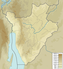
| Description | Map of Burundi, parameters equivalent to File:Burundi_location_map.svg |
| Date | |
| Source | Own work |
| Author | Urutseg |
Licensing
I, the copyright holder of this work, hereby publish it under the following license:
| This file is made available under the Creative Commons CC0 1.0 Universal Public Domain Dedication. | |
| The person who associated a work with this deed has dedicated the work to the public domain by waiving all of their rights to the work worldwide under copyright law, including all related and neighboring rights, to the extent allowed by law. You can copy, modify, distribute and perform the work, even for commercial purposes, all without asking permission.
|
File history
Click on a date/time to view the file as it appeared at that time.
| Date/Time | Thumbnail | Dimensions | User | Comment | |
|---|---|---|---|---|---|
| current | 16:51, 11 March 2011 | | 851 × 929 (696 KB) | Urutseg |
File usage
There are no pages that use this file.
Global file usage
The following other wikis use this file:
- Usage on ar.wikipedia.org
- Usage on az.wikipedia.org
- Usage on ba.wikipedia.org
- Usage on bg.wikipedia.org
- Usage on bn.wikipedia.org
- Usage on bs.wikipedia.org
- Usage on ce.wikipedia.org
- Usage on ckb.wikipedia.org
- Usage on cs.wikipedia.org
- Usage on de.wikipedia.org
- Usage on de.wikivoyage.org
- Usage on el.wikipedia.org
- Usage on en.wikipedia.org
- Gitega
- Kirundo Province
- Bubanza
- Karuzi
- Muramvya
- Melchior Ndadaye International Airport
- Kibumbu
- Gisozi, Burundi
- Gihofi
- Karera waterfalls
- Mount Kikizi
- Gihanga, Burundi
- Mpanda, Mpanda
- Rusizi National Park
- Ruvubu National Park
- Ruvyironza River
- Mount Heha
- Musongati
- Rumonge
- Bururi Forest Nature Reserve
- Muyaga, Burundi
- Module:Location map/data/Burundi/doc
- Commune of Cendajuru
- Commune of Bugabira
- Commune of Busoni
- Commune of Bwambarangwe
- Commune of Gitobe
- Commune of Kirundo
- Commune of Ntega
- Commune of Vumbi
View more global usage of this file.
Explore the world

United states
New York

Japan
Tokyo

Singapore
Singapore
