
 Français
 Italiano
Size of this PNG preview of this SVG file: 800 × 574 pixels. Other resolutions: 320 × 230 pixels | 640 × 460 pixels | 1,024 × 735 pixels | 1,280 × 919 pixels | 2,560 × 1,838 pixels | 1,259 × 904 pixels.
Original file (SVG file, nominally 1,259 × 904 pixels, file size: 80 KB)
This is a file from the Wikimedia Commons and may be used by other projects. Information from its description page there is shown below. Commons is a freely licensed media file repository. |
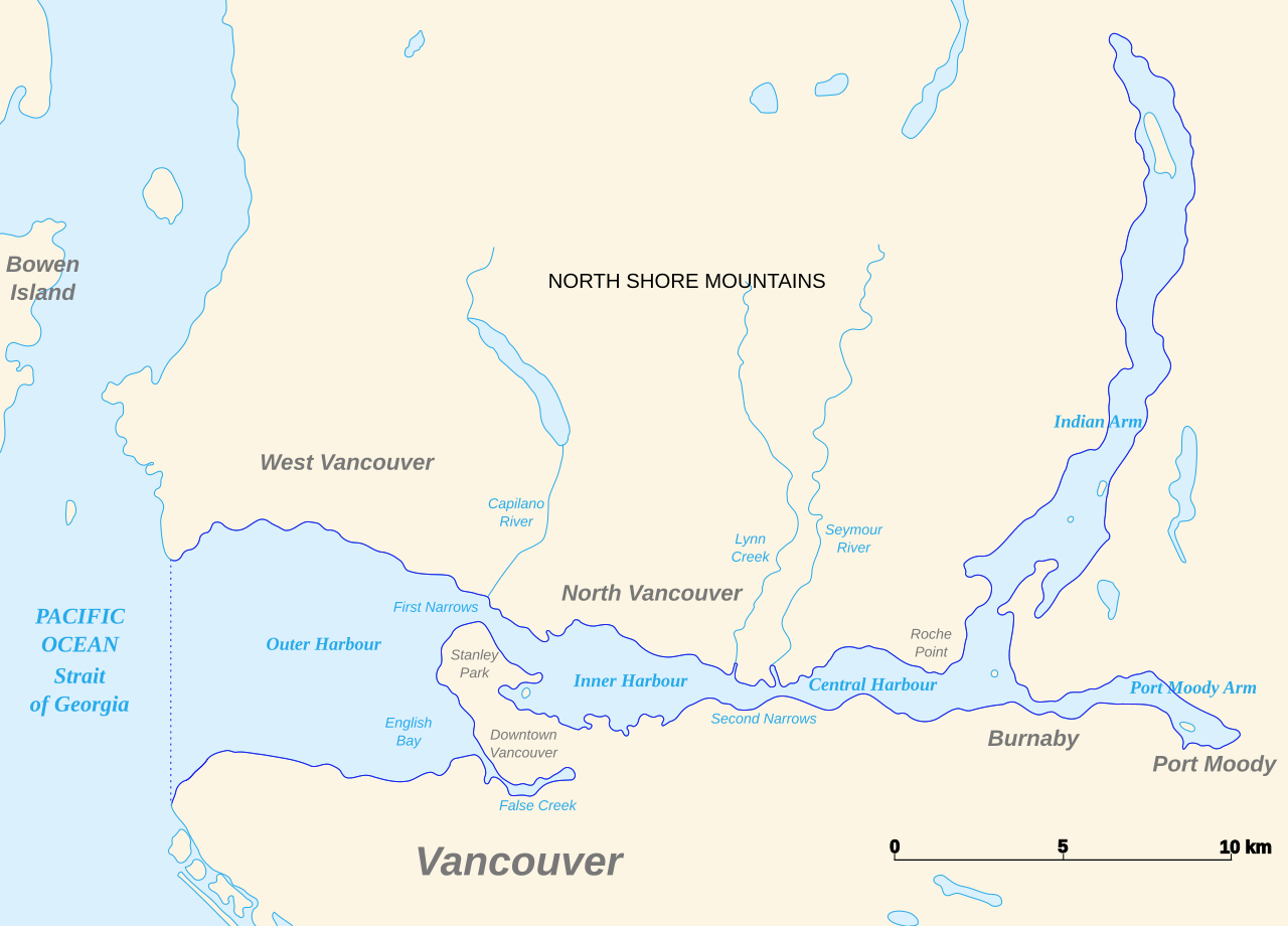
| Description | English: Map of Burrard Inlet |
| Date | (UTC) |
| Source | |
| Author |
|
| This is a retouched picture, which means that it has been digitally altered from its original version. Modifications: Translated. The original can be viewed here: Baie Burrard carte avec toponymes en francais.svg:
|
I, the copyright holder of this work, hereby publish it under the following licenses:
This file is licensed under the Creative Commons Attribution-Share Alike 3.0 Unported, 2.5 Generic, 2.0 Generic and 1.0 Generic license.
- You are free:
- to share – to copy, distribute and transmit the work
- to remix – to adapt the work
- Under the following conditions:
- attribution – You must give appropriate credit, provide a link to the license, and indicate if changes were made. You may do so in any reasonable manner, but not in any way that suggests the licensor endorses you or your use.
- share alike – If you remix, transform, or build upon the material, you must distribute your contributions under the same or compatible license as the original.
 | Permission is granted to copy, distribute and/or modify this document under the terms of the GNU Free Documentation License, Version 1.2 or any later version published by the Free Software Foundation; with no Invariant Sections, no Front-Cover Texts, and no Back-Cover Texts. A copy of the license is included in the section entitled GNU Free Documentation License. |
You may select the license of your choice.
Original upload log
This image is a derivative work of the following images:
- File:Baie_Burrard_carte_avec_toponymes_en_francais.svg licensed with Cc-by-sa-3.0,2.5,2.0,1.0, GFDL
- 2007-11-22T22:48:59Z Arct 1273x918 (94000 Bytes)
- 2007-11-21T22:05:09Z Arct 1273x918 (71725 Bytes) Carte de la baie Burrard au Nord de Vancouver en Colombie-Britannique au Canada, avec quelques toponymes dont certains traduits en français. Données du contour des rivages obtenues sur le [ftp://e0srp01u.ecs.nasa.gov/srtm/
- 2007-11-21T01:20:20Z Arct 1273x918 (71742 Bytes)
- 2007-11-21T01:19:09Z Arct 1273x918 (68835 Bytes)
- 2007-11-20T23:52:27Z Arct 1273x918 (66917 Bytes) {{Information |Description=Carte de la baie Burrard au Nord de Vancouver en Colombie-Britannique au Canada, avec quelques toponymes dont certains traduits en français. Données du contour des rivages obtenues sur le [ftp://e
Uploaded with derivativeFX
File history
Click on a date/time to view the file as it appeared at that time.
| Date/Time | Thumbnail | Dimensions | User | Comment | |
|---|---|---|---|---|---|
| current | 18:26, 12 March 2011 | | 1,259 × 904 (80 KB) | Themightyquill | oops, restore opacity |
| 18:26, 12 March 2011 |  | 1,259 × 904 (80 KB) | Themightyquill | trim borders | |
| 18:21, 12 March 2011 |  | 1,273 × 918 (91 KB) | Themightyquill | {{Information |Description={{en|Map of Burrard Inslet}} |Source=*File:Baie_Burrard_carte_avec_toponymes_en_francais.svg |Date=2011-03-12 18:19 (UTC) |Author=*File:Baie_Burrard_carte_avec_toponymes_en_francais.svg: Arct *derivativ |
File usage
There are no pages that use this file.
Global file usage
The following other wikis use this file:
- Usage on en.wikipedia.org
- Usage on fa.wikipedia.org
- Usage on fy.wikipedia.org
Explore the world

United states
New York

Japan
Tokyo

Singapore
Singapore
