
 Français
 Italiano
Size of this preview: 343 × 599 pixels. Other resolutions: 137 × 240 pixels | 274 × 480 pixels | 439 × 768 pixels | 1,276 × 2,230 pixels.
Original file (1,276 × 2,230 pixels, file size: 435 KB, MIME type: image/png)
This is a file from the Wikimedia Commons and may be used by other projects. Information from its description page there is shown below. Commons is a freely licensed media file repository. |
Summary
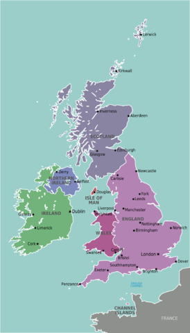
| Description | Map of The British & Irish Isles for use on Wikivoyage, English version |
| Date | 6 February |
| Source | Own work based on the map of UK |
| Author | Stefan Ertmann, amendments by Peterfitzgerald |
| Other versions |
.png)
Licensing
 | Permission is granted to copy, distribute and/or modify this document under the terms of the GNU Free Documentation License, Version 1.2 or any later version published by the Free Software Foundation; with no Invariant Sections, no Front-Cover Texts, and no Back-Cover Texts. A copy of the license is included in the section entitled GNU Free Documentation License. |
This file is licensed under the Creative Commons Attribution-Share Alike 4.0 International, 3.0 Unported, 2.5 Generic, 2.0 Generic and 1.0 Generic license.
- You are free:
- to share – to copy, distribute and transmit the work
- to remix – to adapt the work
- Under the following conditions:
- attribution – You must give appropriate credit, provide a link to the license, and indicate if changes were made. You may do so in any reasonable manner, but not in any way that suggests the licensor endorses you or your use.
- share alike – If you remix, transform, or build upon the material, you must distribute your contributions under the same or compatible license as the original.
Original upload log
| This file was imported from Wikivoyage WTS. |
The original description page was here. All following user names refer to wts.wikivoyage-old.
- 2009-02-05 23:26 (WT-shared) Sertmann[dead link] 675×1129 (224851 bytes) {{Imagecredit|credit=Stefan Ertmann|captureDate=6 February|location=Europe|source=http://commons.wikimedia.org/wiki/File:British_Isles_Unite (Import from wikitravel.org/shared)
- 2009-07-13 22:29 (WT-shared) Peterfitzgerald archive copy at the Wayback Machine 1134×1982 (404899 bytes) +more English cities (Import from wikitravel.org/shared)
- 2012-09-09 22:15 Atsirlin[dead link] 1276×2230 (445408 bytes) cleanup
File history
Click on a date/time to view the file as it appeared at that time.
| Date/Time | Thumbnail | Dimensions | User | Comment | |
|---|---|---|---|---|---|
| current | 23:43, 19 November 2012 | | 1,276 × 2,230 (435 KB) | OgreBot | (BOT): Reverting to most recent version before archival |
| 23:43, 19 November 2012 |  | 1,134 × 1,982 (395 KB) | OgreBot | (BOT): Uploading old version of file from wts.wikivoyage-old; originally uploaded on 2009-07-13 22:29:51 by (WT-shared) Peterfitzgerald | |
| 23:43, 19 November 2012 |  | 675 × 1,129 (220 KB) | OgreBot | (BOT): Uploading old version of file from wts.wikivoyage-old; originally uploaded on 2009-02-05 23:26:39 by (WT-shared) Sertmann | |
| 23:23, 19 November 2012 |  | 1,276 × 2,230 (435 KB) | OgreBot | (BOT): Reverting to most recent version before archival | |
| 23:23, 19 November 2012 |  | 1,134 × 1,982 (395 KB) | OgreBot | (BOT): Uploading old version of file from wts.wikivoyage-old; originally uploaded on 2009-07-13 22:29:51 by (WT-shared) Peterfitzgerald | |
| 23:23, 19 November 2012 |  | 675 × 1,129 (220 KB) | OgreBot | (BOT): Uploading old version of file from wts.wikivoyage-old; originally uploaded on 2009-02-05 23:26:39 by (WT-shared) Sertmann | |
| 22:57, 17 November 2012 |  | 1,276 × 2,230 (435 KB) | MGA73bot2 | {{BotMoveToCommons|wts.oldwikivoyage|year={{subst:CURRENTYEAR}}|month={{subst:CURRENTMONTHNAME}}|day={{subst:CURRENTDAY}}}} == {{int:filedesc}} == {{Information |description=Map of The British & Irish Isles. Map of The British & Irish Isles region.<br>... |
File usage
The following page uses this file:
Global file usage
The following other wikis use this file:
- Usage on ast.wikipedia.org
- Usage on ca.wikipedia.org
- Usage on diq.wikipedia.org
- Usage on el.wikivoyage.org
- Usage on en.wikipedia.org
- Usage on eo.wikivoyage.org
- Usage on eu.wikipedia.org
- Usage on fr.wikivoyage.org
- Usage on ga.wikipedia.org
- Usage on he.wikivoyage.org
- Usage on hi.wikivoyage.org
- Usage on hsb.wikipedia.org
- Usage on incubator.wikimedia.org
- Usage on it.wikivoyage.org
- Usage on ja.wikivoyage.org
- Usage on nl.wikivoyage.org
- Usage on oc.wikipedia.org
- Usage on pnb.wikipedia.org
- Usage on simple.wikipedia.org
- Usage on uk.wikivoyage.org
- Usage on ur.wikipedia.org
- Usage on www.wikidata.org
Metadata
Explore the world

United states
New York

Japan
Tokyo

Singapore
Singapore
