
 Français
 Italiano
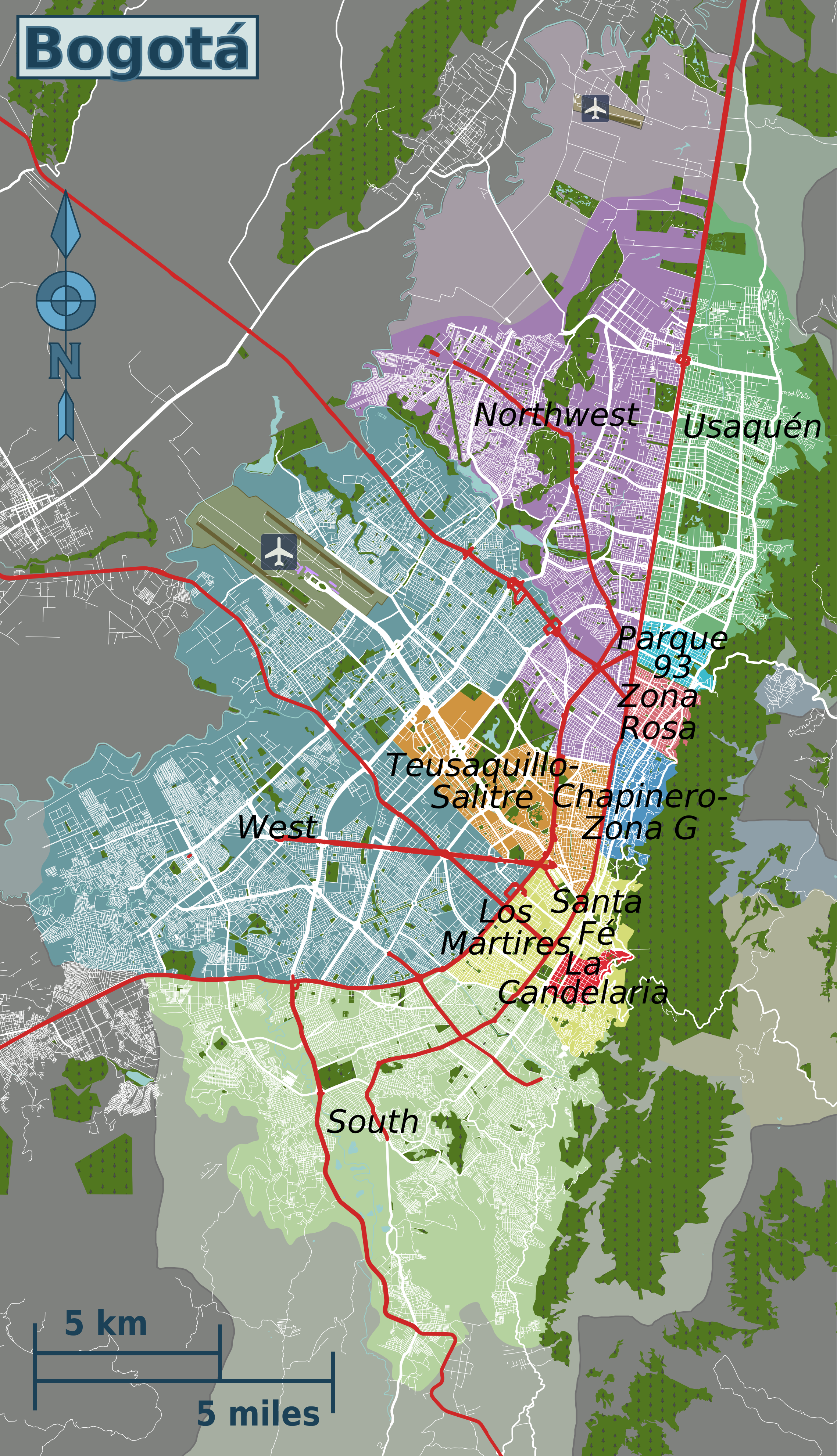
Size of this preview: 344 × 599 pixels. Other resolutions: 138 × 240 pixels | 276 × 480 pixels | 441 × 768 pixels | 588 × 1,024 pixels | 2,277 × 3,964 pixels.
Original file (2,277 × 3,964 pixels, file size: 6.46 MB, MIME type: image/png)
This is a file from the Wikimedia Commons and may be used by other projects. Information from its description page there is shown below. Commons is a freely licensed media file repository. |
| Description | English: Map of Bogotá's travel districts (English version) | |||
| Date | ||||
| Source | File:Bogota districts map.svg | |||
| Author | Peter Fitzgerald, OpenStreetMap | |||
| Permission (Reusing this file) | This file is licensed under the Creative Commons Attribution-Share Alike 2.0 Generic license.
|
File history
Click on a date/time to view the file as it appeared at that time.
| Date/Time | Thumbnail | Dimensions | User | Comment | |
|---|---|---|---|---|---|
| current | 21:14, 27 March 2013 | | 2,277 × 3,964 (6.46 MB) | Peterfitzgerald | merging Los Mártires into Santa Fé-Los Mártires |
| 21:52, 14 March 2013 |  | 2,277 × 3,964 (6.47 MB) | Peterfitzgerald | separating out Los Mártires | |
| 04:04, 25 February 2013 |  | 2,277 × 3,964 (6.45 MB) | Peterfitzgerald | incorporate Ciudad Salitre & Botanical Gardens into Teusaquillo-Salitre | |
| 03:16, 25 February 2013 |  | 2,277 × 3,964 (6.45 MB) | Peterfitzgerald | {{Information |Description ={{en|1=Map of Bogotá's travel districts (English version)}} |Source =File:Bogota districts map.png |Author =Peter Fitzgerald, [http://openstreetmap.org OpenStreetMap] |Date ... |
File usage
The following 2 pages use this file:
Global file usage
The following other wikis use this file:
Metadata
Explore the world

United states
New York

Japan
Tokyo

Singapore
Singapore
