
 Français
 Italiano
Size of this PNG preview of this SVG file: 295 × 590 pixels. Other resolutions: 120 × 240 pixels | 240 × 480 pixels | 384 × 768 pixels | 512 × 1,024 pixels | 1,024 × 2,048 pixels.
Original file (SVG file, nominally 295 × 590 pixels, file size: 101 KB)
This is a file from the Wikimedia Commons and may be used by other projects. Information from its description page there is shown below. Commons is a freely licensed media file repository. |
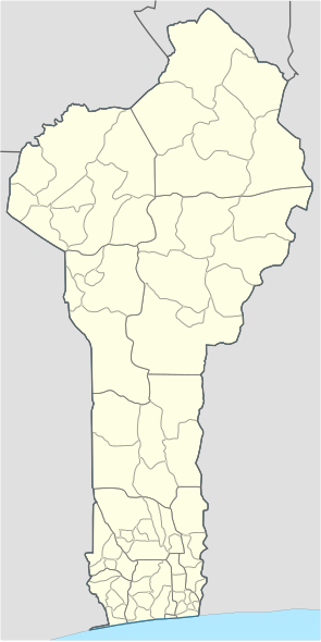
| Description | Localization map of Benin with departements & communes |
| Date | (UTC) |
| Source | |
| Author |
|
| This is a retouched picture, which means that it has been digitally altered from its original version. The original can be viewed here: Benin loc map+dep.svg:
|
This file is licensed under the Creative Commons Attribution-Share Alike 3.0 Unported license.
- You are free:
- to share – to copy, distribute and transmit the work
- to remix – to adapt the work
- Under the following conditions:
- attribution – You must give appropriate credit, provide a link to the license, and indicate if changes were made. You may do so in any reasonable manner, but not in any way that suggests the licensor endorses you or your use.
- share alike – If you remix, transform, or build upon the material, you must distribute your contributions under the same or compatible license as the original.
Original upload log
This image is a derivative work of the following images:
- File:Benin_communes.png licensed with PD-user
- 2006-12-04T19:53:30Z Electionworld 816x1056 (18497 Bytes) {{ew|en|Rarelibra}} Map of the communes of Benin. Created by Rarelibra for public domain use. Created using MapInfo Professional v7.5 and various mapping resources. == Licensing == {{PD-user|Rarelibra}}
- File:Benin_loc_map+dep.svg licensed with Cc-by-sa-3.0-migrated, GFDL
- 2007-07-07T09:38:50Z Gvf 295x590 (12268 Bytes) {{Information |Description=Localization map of Benin (+departements) |Source=Lavoro personale |Date=7/7/2007 |Author=[[Utente:Gvf]] |Permission={{GFDL}} |other_versions=[[:Image:Benin loc map.svg]] }}
Uploaded with derivativeFX
File history
Click on a date/time to view the file as it appeared at that time.
| Date/Time | Thumbnail | Dimensions | User | Comment | |
|---|---|---|---|---|---|
| current | 18:45, 11 November 2009 | | 295 × 590 (101 KB) | Olivier d'ALLIVY KELLY | * Changement des couleurs (harmonisation avec les couleurs des cartes usuelles) * Changement des épaisseurs relatives des frontières * Modifications techniques rendant le fichier plus facilement éditable |
| 18:38, 11 November 2009 |  | 295 × 590 (101 KB) | Olivier d'ALLIVY KELLY | ||
| 04:45, 12 October 2009 |  | 295 × 590 (162 KB) | Zmiley | {{Information |Description=Localization map of Benin with departements & communes |Source=*File:Benin_communes.png *File:Benin_loc_map+dep.svg |Date=2009-10-12 04:26 (UTC) |Author=*File:Benin_communes.png: User:Rarelibra *[[:File:Ben |
File usage
There are no pages that use this file.
Global file usage
The following other wikis use this file:
- Usage on en.wikipedia.org
- Cotonou
- Porto-Novo
- Abomey
- Ouidah
- Bohicon
- Dassa-Zoumé
- Parakou
- Djougou
- Malanville
- Natitingou
- Boukoumbé
- Savè
- Abomey-Calavi
- Allada
- Aplahoué
- Athiémè
- Banikoara
- Bassila
- Bembèrèkè
- Comè
- Cové
- Dogbo-Tota
- Lokossa
- Kérou
- Kétou, Benin
- Kouandé
- Nikki, Benin
- Péhunco
- Pobè
- Sakété
- Savalou
- Ségbana
- Tanguiéta
- Tchaourou
- Karimama, Benin
- Gogounou
- Adjarra
- Adjohoun
- Akpro-Missérété
- N'Dali
- Bantè
- Template:Communes of Benin
- Cobly
- Matéri
- Toucountouna
- Kpomassè
- Sô-Ava
- Toffo
- Tori-Bossito
- Zè
View more global usage of this file.
Explore the world

United states
New York

Japan
Tokyo

Singapore
Singapore
