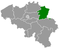
Belgielimburg.png (398 × 335 pixels, file size: 6 KB, MIME type: image/png)
File history
Click on a date/time to view the file as it appeared at that time.
| Date/Time | Thumbnail | Dimensions | User | Comment | |
|---|---|---|---|---|---|
| current | 18:52, 24 May 2006 |  | 398 × 335 (6 KB) | Btrs | {{Information| |Description= Map of Belgium with the 3 regions togheter , with the province of Limburg colored green. |Source=Wikimedia Commons (Article 'Maps_of_Belgium') |Date=24 May 2006 |Author=User 'Morwen' |Permission=none needed , seen the GNU Free |
File usage
There are no pages that use this file.
Global file usage
The following other wikis use this file:
- Usage on af.wikipedia.org
- Sint-Truiden
- Wellen
- Gingelom
- Lummen
- Hasselt, België
- Genk
- Alken
- As, België
- Beringen
- Bilzen
- Bocholt, België
- Borgloon
- Bree
- Diepenbeek
- Dilsen-Stokkem
- Halen
- Ham (België)
- Hamont-Achel
- Hechtel-Eksel
- Heers
- Herk-de-Stad
- Tongeren
- Herstappe
- Heusden-Zolder
- Hoeselt
- Houthalen-Helchteren
- Kinrooi
- Kortessem
- Lanaken
- Leopoldsburg
- Lommel
- Maaseik
- Maasmechelen
- Nieuwerkerken
- Peer, België
- Riemst
- Tessenderlo
- Voeren
- Zonhoven
- Zutendaal
- Sjabloon:Munisipaliteite in Limburg, België
- Pelt
- Oudsbergen
- Bilzen-Hoeselt
- Tessenderlo-Ham
- Tongeren-Borgloon
- Usage on ar.wikipedia.org
View more global usage of this file.


 Français
 Italiano


