
 Français
 Italiano
Size of this PNG preview of this SVG file: 485 × 599 pixels. Other resolutions: 194 × 240 pixels | 389 × 480 pixels | 622 × 768 pixels | 829 × 1,024 pixels | 1,659 × 2,048 pixels | 852 × 1,052 pixels.
Original file (SVG file, nominally 852 × 1,052 pixels, file size: 1.08 MB)
This is a file from the Wikimedia Commons and may be used by other projects. Information from its description page there is shown below. Commons is a freely licensed media file repository. |
Summary
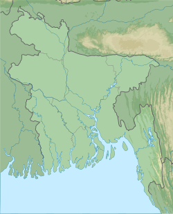
| Description | English: Bangladesh physical map, parameters equal to File:Bangladesh location map.svg |
| Date | |
| Source | Own work |
| Author | Urutseg |
Licensing
I, the copyright holder of this work, hereby publish it under the following license:
| This file is made available under the Creative Commons CC0 1.0 Universal Public Domain Dedication. | |
| The person who associated a work with this deed has dedicated the work to the public domain by waiving all of their rights to the work worldwide under copyright law, including all related and neighboring rights, to the extent allowed by law. You can copy, modify, distribute and perform the work, even for commercial purposes, all without asking permission.
|
File history
Click on a date/time to view the file as it appeared at that time.
| Date/Time | Thumbnail | Dimensions | User | Comment | |
|---|---|---|---|---|---|
| current | 05:57, 17 December 2013 | | 852 × 1,052 (1.08 MB) | Wereldburger758 | added Divisional Boundary for Rangpur Division |
| 06:23, 23 February 2011 |  | 852 × 1,052 (1.63 MB) | Urutseg | {{Information |Description ={{en|1=Bangladesh physical map, parameters equal to File:Bangladesh location map.svg}} |Source ={{own}} |Author =Urutseg |Date =2011-02-23 |Permission = |other_versions = } |
File usage
There are no pages that use this file.
Global file usage
The following other wikis use this file:
- Usage on als.wikipedia.org
- Usage on ar.wikipedia.org
- Usage on as.wikipedia.org
- Usage on az.wikipedia.org
- Usage on ba.wikipedia.org
- Usage on be.wikipedia.org
- Usage on bg.wikipedia.org
- Usage on bn.wikipedia.org
- সুন্দরবন
- বলধা গার্ডেন
- মাধবকুণ্ড ইকোপার্ক
- পাবলাখালী বন্যপ্রাণী অভয়ারণ্য
- লাউয়াছড়া জাতীয় উদ্যান
- সাতছড়ি জাতীয় উদ্যান
- ডুলাহাজারা সাফারি পার্ক
- মধুপুর জাতীয় উদ্যান
- বাংলাদেশের জাতীয় উদ্যান
- টেমপ্লেট:অবস্থান মানচিত্র বাংলাদেশ
- টেকনাফ বন্যপ্রাণ অভয়ারণ্য
- চুনতি বন্যপ্রাণী অভয়ারণ্য
- রামসাগর জাতীয় উদ্যান
- ভাওয়াল জাতীয় উদ্যান
- কাপ্তাই জাতীয় উদ্যান
- হিমছড়ি জাতীয় উদ্যান
- টেমপ্লেট:অবস্থান মানচিত্র বাংলাদেশ/নথি
- রেমা–কালেঙ্গা বন্যপ্রাণী অভয়ারণ্য
- বাংলাদেশের সংরক্ষিত এলাকার তালিকা
- জাতীয় উদ্ভিদ উদ্যান, বাংলাদেশ
- নিঝুম দ্বীপ জাতীয় উদ্যান
- টেমপ্লেট:বাংলাদেশের সংরক্ষিত বনাঞ্চল
- সিংড়া জাতীয় উদ্যান
View more global usage of this file.
Metadata
Explore the world

United states
New York

Japan
Tokyo

Singapore
Singapore
