
 Français
 Italiano
Size of this PNG preview of this SVG file: 530 × 599 pixels. Other resolutions: 212 × 240 pixels | 425 × 480 pixels | 679 × 768 pixels | 906 × 1,024 pixels | 1,812 × 2,048 pixels | 1,075 × 1,215 pixels.
Original file (SVG file, nominally 1,075 × 1,215 pixels, file size: 206 KB)
This is a file from the Wikimedia Commons and may be used by other projects. Information from its description page there is shown below. Commons is a freely licensed media file repository. |
Summary
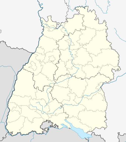
| Description | Quadratische Plattkarte. Geographische Begrenzung der Karte:
Equirectangular projection. Geographic limits of the map:
|
| Date | |
| Source | own work, created from File:Baden wuerttemberg template.svg, File:Germany location map.svg, and GMT coastlines base data |
| Author | Ssch,kjunix |
| Other versions | Derivative works of this file: Location map of the scope of the Rhein-Main-Verkehrsverbund.svg
|
| SVG development |

Licensing
I, the copyright holder of this work, hereby publish it under the following licenses:
 | Permission is granted to copy, distribute and/or modify this document under the terms of the GNU Free Documentation License, Version 1.2 or any later version published by the Free Software Foundation; with no Invariant Sections, no Front-Cover Texts, and no Back-Cover Texts. A copy of the license is included in the section entitled GNU Free Documentation License. |
This file is licensed under the Creative Commons Attribution-Share Alike 3.0 Unported license.
- You are free:
- to share – to copy, distribute and transmit the work
- to remix – to adapt the work
- Under the following conditions:
- attribution – You must give appropriate credit, provide a link to the license, and indicate if changes were made. You may do so in any reasonable manner, but not in any way that suggests the licensor endorses you or your use.
- share alike – If you remix, transform, or build upon the material, you must distribute your contributions under the same or compatible license as the original.
You may select the license of your choice.
File history
Click on a date/time to view the file as it appeared at that time.
| Date/Time | Thumbnail | Dimensions | User | Comment | |
|---|---|---|---|---|---|
| current | 15:12, 27 January 2009 | | 1,075 × 1,215 (206 KB) | Kjunix | new version with administrative district borders and complete Rheine, Neckar and Main |
| 21:14, 15 November 2008 |  | 1,075 × 1,215 (248 KB) | Kjunix | == Beschreibung == {{Information |Description= {{de|Positionskarte von Baden-Württemberg, Deutschland}} Quadratische Plattkarte. Geographische Begrenzung der Karte: * N: 54.8° N * S: 53.0° N * W: 10.4° O |
File usage
There are no pages that use this file.
Global file usage
The following other wikis use this file:
- Usage on als.wikipedia.org
- Erdmannshöhle
- Ulm (Baden)
- Harpolingen
- Dreiländerbrücke
- Vorlage:Positionskarte Deutschland Baden-Württemberg
- Aachtopf
- Bärenhöhle
- Blauhöhlensystem
- Kernkraftwerk Wyhl
- Kraftwerk Witznau
- Achdorf (Blumberg)
- Flusskraftwerk Stallegg
- Palmrainbrücke
- Kraftwerk Reckingen
- Schänzlebrücke
- Fahrradbrücke (Konstanz)
- Rheinbrücke Konstanz
- Rheinbrücke Albbruck–Schwaderloch
- Alte Rheinbrücke Rheinfelden
- Ravennabrücke
- Laufenbrücke
- Hochrheinbrücke
- Holzbrücke Bad Säckingen
- Fridolinsbrücke
- Bahnhof Erzingen (Baden)
- Kraftwerk Häusern
- Kraftwerk Waldshut
- Kraftwerk Eichholz
- Eisenbahnviadukt Hornberg
- Zöbingen
- Zollhaus (Blumberg)
- Usage on ar.wikipedia.org
- Usage on azb.wikipedia.org
- Usage on ba.wikipedia.org
- Usage on be.wikipedia.org
- Usage on bg.wikipedia.org
View more global usage of this file.
Metadata
Explore the world

United states
New York

Japan
Tokyo

Singapore
Singapore
