
 Français
 Italiano
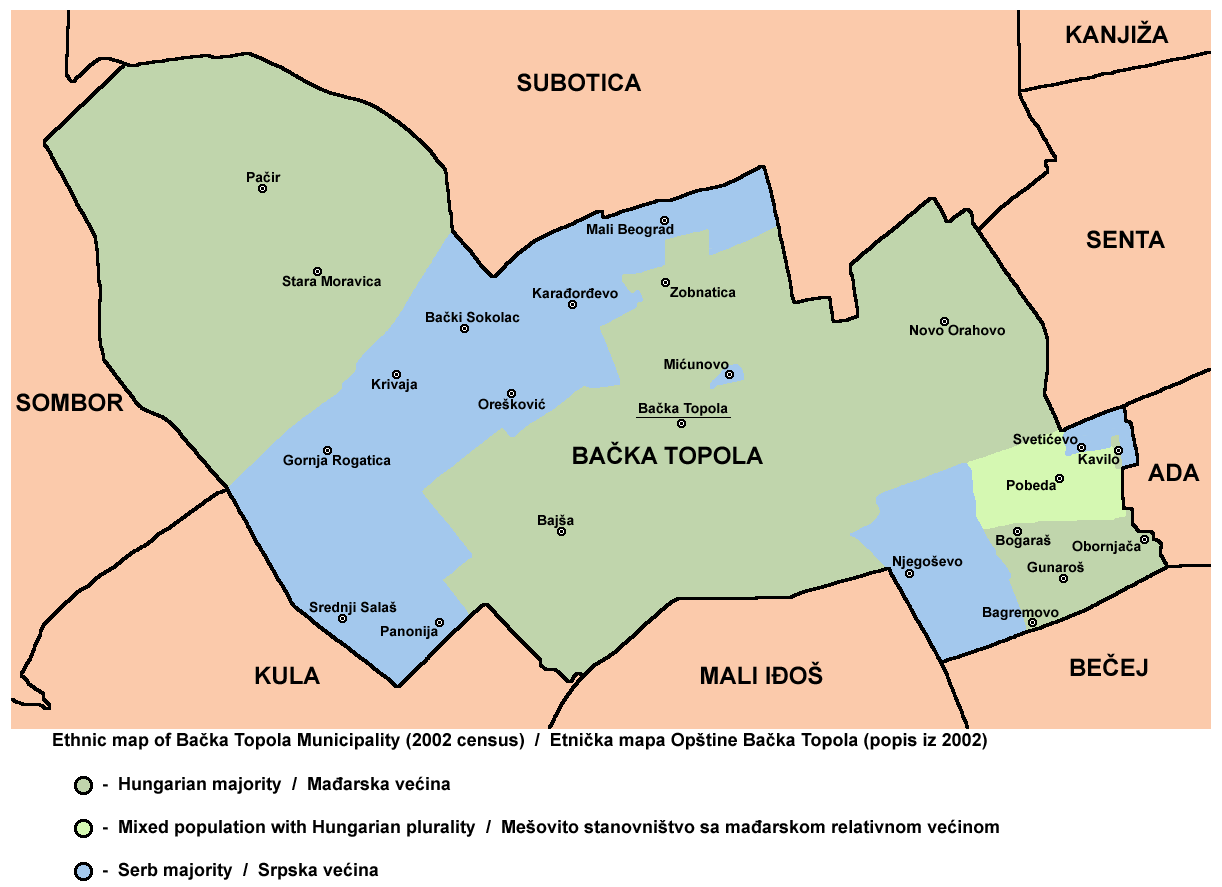
Size of this preview: 800 × 581 pixels. Other resolutions: 320 × 232 pixels | 640 × 465 pixels | 1,024 × 743 pixels | 1,222 × 887 pixels.
Original file (1,222 × 887 pixels, file size: 84 KB, MIME type: image/png)
This is a file from the Wikimedia Commons and may be used by other projects. Information from its description page there is shown below. Commons is a freely licensed media file repository. |
Summary
| Description | English: ethnic map of Bačka Topola municipality, Vojvodina, Serbia Српски / srpski: етничка мапа општине Бачка Топола, Војводина, Србија |
| Date | 8 February 2009 (original upload date) |
| Source | No machine-readable source provided. Own work assumed (based on copyright claims). |
| Author | No machine-readable author provided. WikiEditor2004 assumed (based on copyright claims). |
Source and licence
self made map by WikiEditor2004
Licensing
| I, the copyright holder of this work, release this work into the public domain. This applies worldwide. In some countries this may not be legally possible; if so: I grant anyone the right to use this work for any purpose, without any conditions, unless such conditions are required by law. |
File history
Click on a date/time to view the file as it appeared at that time.
| Date/Time | Thumbnail | Dimensions | User | Comment | |
|---|---|---|---|---|---|
| current | 08:54, 13 September 2013 | | 1,222 × 887 (84 KB) | WikiEditor2004 | improved version |
| 20:37, 8 February 2009 |  | 1,037 × 689 (51 KB) | WikiEditor2004 | ethnic map of Bačka Topola municipality (self made) {{PD-self}} Category:Maps of municipalities of Vojvodina |
File usage
There are no pages that use this file.
Global file usage
The following other wikis use this file:
- Usage on arz.wikipedia.org
- Usage on be-tarask.wikipedia.org
- Usage on bs.wikipedia.org
- Usage on ceb.wikipedia.org
- Usage on ce.wikipedia.org
- Usage on en.wikipedia.org
- Usage on eo.wikipedia.org
- Usage on es.wikipedia.org
- Usage on fa.wikipedia.org
- Usage on hu.wikipedia.org
- Usage on it.wikipedia.org
- Usage on jv.wikipedia.org
View more global usage of this file.
Explore the world

United states
New York

Japan
Tokyo

Singapore
Singapore
