
 Français
 Italiano
Size of this preview: 800 × 446 pixels. Other resolutions: 320 × 178 pixels | 640 × 357 pixels | 1,256 × 700 pixels.
Original file (1,256 × 700 pixels, file size: 677 KB, MIME type: image/jpeg)
This is a file from the Wikimedia Commons and may be used by other projects. Information from its description page there is shown below. Commons is a freely licensed media file repository. |
Summary
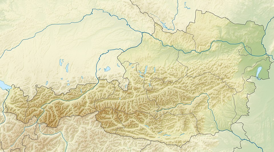
| Description | English: Location map of Austria Equirectangular projection, N/S stretching 150 %. Geographic limits of the map:
|
| Date | |
| Source | Own work |
| Author | Uwe Dedering |
| Other versions | Derivative works of this file: ÖRF 2011.png
|

Licensing
I, the copyright holder of this work, hereby publish it under the following licenses:
This file is licensed under the Creative Commons Attribution-Share Alike 3.0 Unported license.
- You are free:
- to share – to copy, distribute and transmit the work
- to remix – to adapt the work
- Under the following conditions:
- attribution – You must give appropriate credit, provide a link to the license, and indicate if changes were made. You may do so in any reasonable manner, but not in any way that suggests the licensor endorses you or your use.
- share alike – If you remix, transform, or build upon the material, you must distribute your contributions under the same or compatible license as the original.
 | Permission is granted to copy, distribute and/or modify this document under the terms of the GNU Free Documentation License, Version 1.2 or any later version published by the Free Software Foundation; with no Invariant Sections, no Front-Cover Texts, and no Back-Cover Texts. A copy of the license is included in the section entitled GNU Free Documentation License. |
You may select the license of your choice.
 | This map image could be re-created using vector graphics as an SVG file. This has several advantages; see Commons:Media for cleanup for more information. If an SVG form of this image is available, please upload it and afterwards replace this template with {{vector version available|new image name}}.It is recommended to name the SVG file “Austria relief location map.svg”—then the template Vector version available (or Vva) does not need the new image name parameter. |


File history
Click on a date/time to view the file as it appeared at that time.
| Date/Time | Thumbnail | Dimensions | User | Comment | |
|---|---|---|---|---|---|
| current | 09:14, 28 June 2010 | | 1,256 × 700 (677 KB) | Uwe Dedering | very little border change |
| 12:24, 26 April 2010 |  | 1,256 × 700 (677 KB) | Uwe Dedering | rhine | |
| 12:54, 24 April 2010 |  | 1,256 × 700 (676 KB) | Uwe Dedering | {{Information |Description={{en|1=Location map of Austria}} Equirectangular projection, N/S stretching 150 %. Geographic limits of the map: * N: 49.2° N * S: 46.3° N * W: 9.4° E * E: 17.2° E Made with Natural Earth. Free |
File usage
There are no pages that use this file.
Global file usage
The following other wikis use this file:
- Usage on ab.wikipedia.org
- Usage on als.wikipedia.org
- Usage on am.wikipedia.org
- Usage on an.wikipedia.org
- Usage on ar.wikipedia.org
- Usage on arz.wikipedia.org
- Usage on ast.wikipedia.org
- Usage on as.wikipedia.org
- Usage on azb.wikipedia.org
- Usage on az.wikipedia.org
- Şablon:Yer xəritəsi Avstriya
- Noyzidler gölü
- Arlberq
- Qrosvenediger
- Koralpe
- Hoçkeynig dağı
- İrott-kö
- Zabot su anbarı
- Lyolnbreyn su anbarı
- Krimler şəlaləsi
- Spannagel mağarası
- Tennen dağları
- Venediger dağları
- Vaysenzee gölü
- Leoqanq dağları
- Kalkalpen Milli Parkı
- Aysrizenvelt mağarası
- Zeqortte mağarası
- Grüner-Ze (Ştiriya)
- Usage on ban.wikipedia.org
- Usage on ba.wikipedia.org
- Usage on be-tarask.wikipedia.org
- Usage on be.wikipedia.org
View more global usage of this file.
Explore the world

United states
New York

Japan
Tokyo

Singapore
Singapore
