
 Français
 Italiano
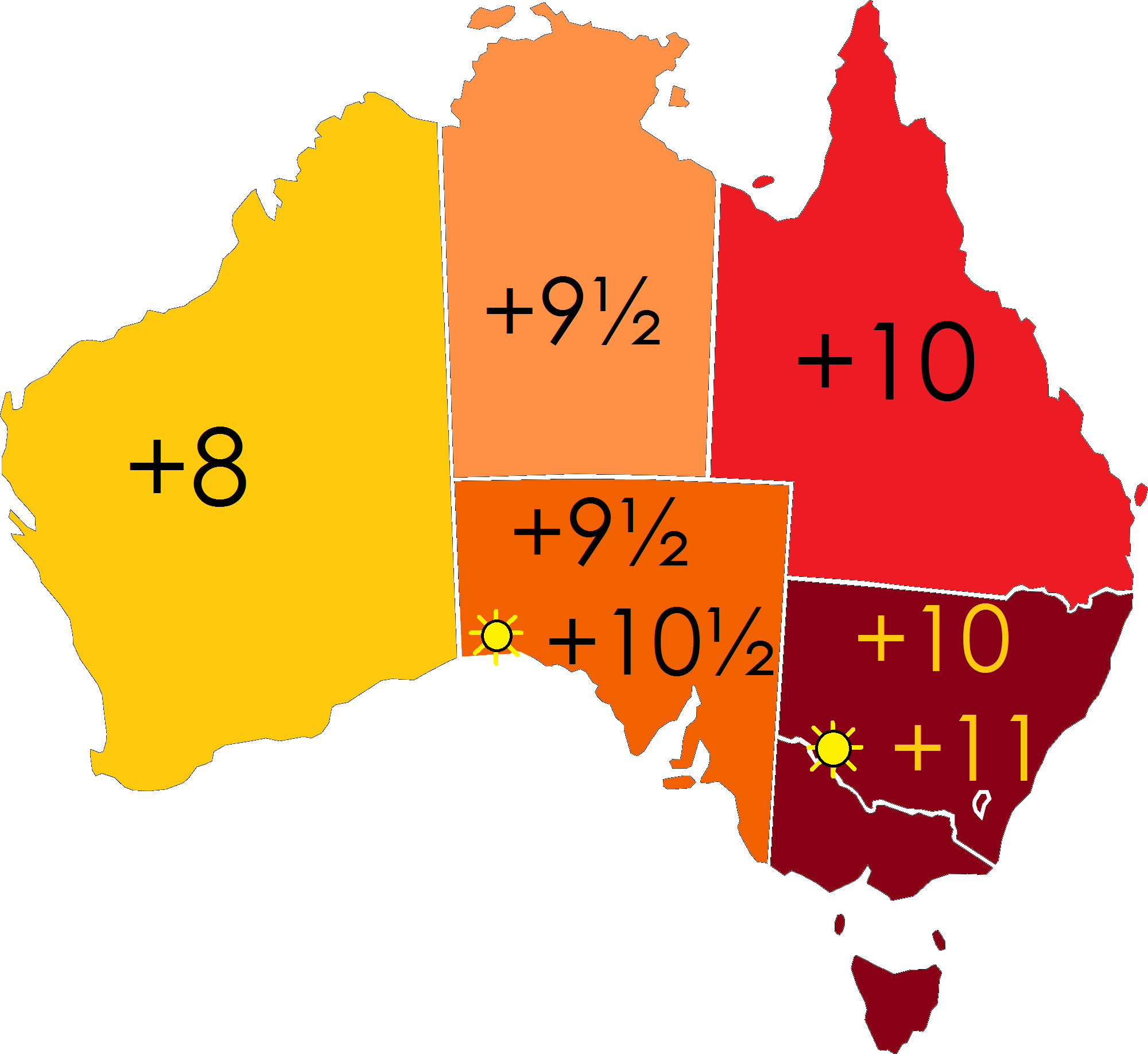
Size of this preview: 653 × 599 pixels. Other resolutions: 261 × 240 pixels | 523 × 480 pixels | 837 × 768 pixels | 1,116 × 1,024 pixels | 2,000 × 1,836 pixels.
Original file (2,000 × 1,836 pixels, file size: 210 KB, MIME type: image/png)
This is a file from the Wikimedia Commons and may be used by other projects. Information from its description page there is shown below. Commons is a freely licensed media file repository. |
 | File:Australia-states-timezones.svg is a vector version of this file. It should be used in place of this PNG file. File:Australia-states-timezones.png → File:Australia-states-timezones.svg For more information, see Help:SVG. |  |
Summary
| Description | English: Map of Australia depicting time zone offsets from UTC by state (including daylight saving times). | ||
| Date | 2 August 2012 | ||
| Source | Own work based on: Australia states blank.svg by Rycherr | ||
| Author | Responsible? | ||
| Permission (Reusing this file) | I, the copyright holder of this work, hereby publish it under the following licenses:
This file is licensed under the Creative Commons Attribution-Share Alike 4.0 International, 3.0 Unported, 2.5 Generic, 2.0 Generic and 1.0 Generic license.
You may select the license of your choice. | ||
| Other versions |


File history
Click on a date/time to view the file as it appeared at that time.
| Date/Time | Thumbnail | Dimensions | User | Comment | |
|---|---|---|---|---|---|
| current | 07:06, 4 July 2023 | | 2,000 × 1,836 (210 KB) | Responsible? | Reverted back to the original -- the intent of this map is to depict Australia, not a much wider area that may be "Australian" politically but not geographically. That just ruins the original & makes an ocean map that's hard to read. Please don't do that. I will upload D000A's version as a separate file. |
| 09:26, 15 April 2023 |  | 1,930 × 1,450 (203 KB) | Vanished user f37815adc29f052df1d76cfb358a06fa | updated to inhabited states and territories only https://www.australia.gov.au/time-zones-and-daylight-saving | |
| 08:26, 15 April 2023 |  | 2,134 × 1,604 (234 KB) | Vanished user f37815adc29f052df1d76cfb358a06fa | Time zones across States and territories of Australia (excluding claimed Australian Antarctic Territory) | |
| 02:11, 4 August 2012 |  | 2,000 × 1,836 (210 KB) | Responsible? | Made suns clearer | |
| 08:02, 2 August 2012 |  | 2,000 × 1,836 (209 KB) | Responsible? | Re-uploaded | |
| 07:44, 2 August 2012 |  | 2,000 × 1,836 (209 KB) | Responsible? |
File usage
There are no pages that use this file.
Metadata
Explore the world

United states
New York

Japan
Tokyo

Singapore
Singapore
