
 Français
 Italiano
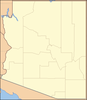
No higher resolution available.
Arizona_Locator_Map.PNG (351 × 407 pixels, file size: 9 KB, MIME type: image/png)
This is a file from the Wikimedia Commons and may be used by other projects. Information from its description page there is shown below. Commons is a freely licensed media file repository. |
Summary
 | File:USA Arizona location map.svg is a vector version of this file. It should be used in place of this PNG file when not inferior. File:Arizona Locator Map.PNG → File:USA Arizona location map.svg For more information, see Help:SVG. |  |
| Description | Locator Map of Arizona, United States |
| Date | |
| Source | taken from US Census website [1] and modified by User:Ruhrfisch |
| Author | US Census, Ruhrfisch |
| Permission (Reusing this file) | US Census / US Government work is public domain, my modifications licensed under the GNU Free Documentation License |
Licensing
I, Ruhrfisch, the copyright holder of this work, hereby publishes it under the following licenses:
 | Permission is granted to copy, distribute and/or modify this document under the terms of the GNU Free Documentation License, Version 1.2 or any later version published by the Free Software Foundation; with no Invariant Sections, no Front-Cover Texts, and no Back-Cover Texts. A copy of the license is included in the section entitled GNU Free Documentation License. |
| This file is licensed under the Creative Commons Attribution-Share Alike 3.0 Unported license. | ||
Attribution: I, Ruhrfisch | ||
| ||
| This licensing tag was added to this file as part of the GFDL licensing update. |
This file is licensed under the Creative Commons Attribution-Share Alike 2.5 Generic license.
Attribution: I, Ruhrfisch
- You are free:
- to share – to copy, distribute and transmit the work
- to remix – to adapt the work
- Under the following conditions:
- attribution – You must give appropriate credit, provide a link to the license, and indicate if changes were made. You may do so in any reasonable manner, but not in any way that suggests the licensor endorses you or your use.
- share alike – If you remix, transform, or build upon the material, you must distribute your contributions under the same or compatible license as the original.
You may select the license of your choice.
This image or file is a work of a United States Census Bureau employee, taken or made as part of that person's official duties. As a work of the U.S. federal government, the image is in the public domain.
|  |
File history
Click on a date/time to view the file as it appeared at that time.
| Date/Time | Thumbnail | Dimensions | User | Comment | |
|---|---|---|---|---|---|
| current | 01:52, 1 August 2007 | | 351 × 407 (9 KB) | Ruhrfisch | Add Lakes Mead and Powell, all other info the same |
| 02:51, 31 July 2007 |  | 351 × 407 (9 KB) | Ruhrfisch | Fixed Mexican state borders, all other info the same | |
| 02:38, 31 July 2007 |  | 351 × 407 (9 KB) | Ruhrfisch | {{Information| |Description= Locator Map of Arizona, United States |Source= taken from US Census website [http://factfinder.census.gov/] and modified by User:Ruhrfisch |Date= July 2007 |Author= US Census, Ruhrfisch |Permission= US Census / US Governm |
File usage
There are no pages that use this file.
Global file usage
The following other wikis use this file:
- Usage on de.wikipedia.org
- Usage on fa.wikipedia.org
- Usage on he.wikipedia.org
- Usage on hu.wikipedia.org
- Usage on incubator.wikimedia.org
- Usage on ro.wikipedia.org
- Usage on ru.wikipedia.org
- Usage on sw.wikipedia.org
- Usage on uz.wikipedia.org
- Usage on zh.wikipedia.org
Explore the world

United states
New York

Japan
Tokyo

Singapore
Singapore
